Lautoka, Fiji Island Tour

cruise ship in Fiji

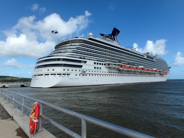
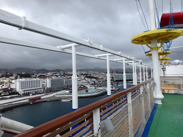
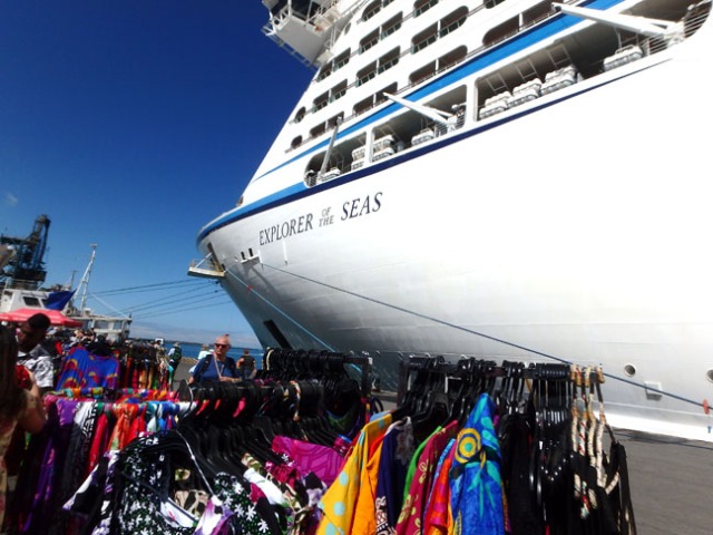
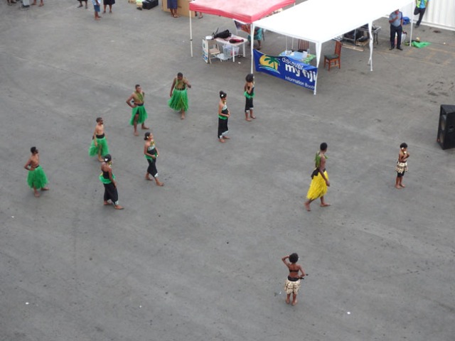
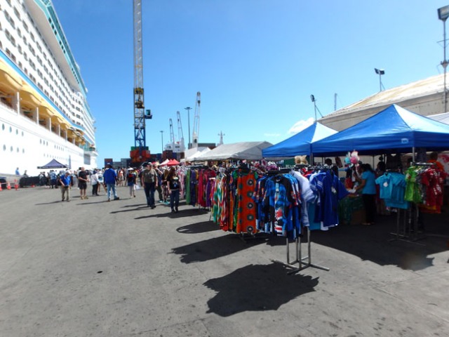
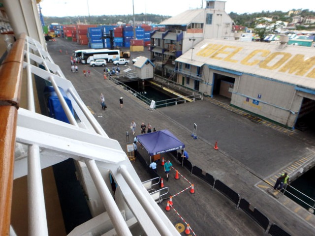
Explorer at the dock in Lautoka, Fiji

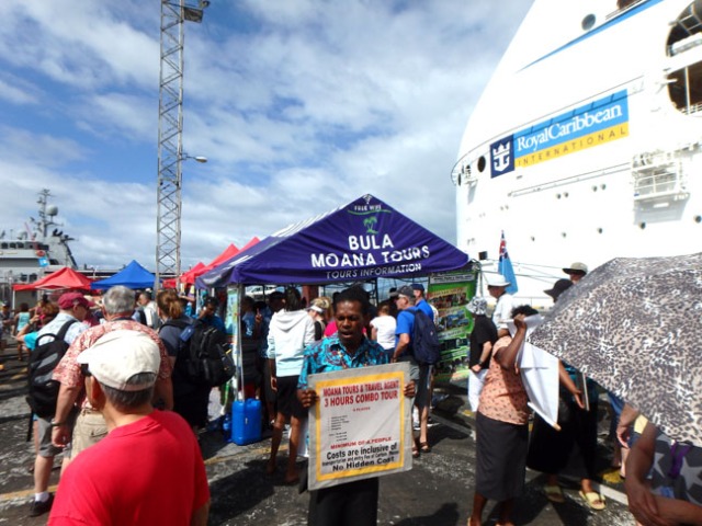
We had no plans for our port stop in Lautoka, Fiji on Royal Caribbean’s Explorer of the Seas. When the ship pulled into port we could see a row of little booths offering tours from the locals. We like local tours. Besides supporting the people who live there, they are also usually considerably cheaper than tours booked on cruise ships.

Lautoka, Fiji cruise ship port

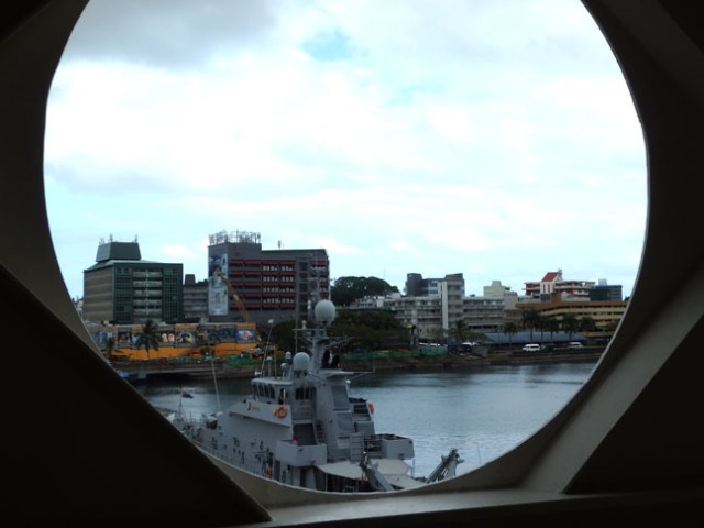
we could see the little booths from the ship so we knew there would be things to do

We booked what was said to be a 3-hour tour through one of the booths after having gone down the line to see where we could get the best deal. The asking rate per person adjusted from Australian to American dollars ran from $30-$35 at all the booths, but we found one willing to bargain and paid $25. We were told to come back at 9:15. They brought all the people waiting there to the bus around that time, but the bus didn’t go anywhere. The next group came in expecting a 9:30 departure, but it didn’t actually leave until they scrounged up a few more people closer to 10am. Island people are often on island time, which means they aren’t exactly prompt. Considering the ship had a 6:30pm all-aboard time they had no reason to feel the need to rush.

not really cannibals

the bus stopped by this store with “cannibals” outside

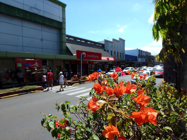
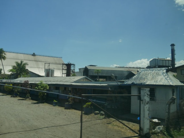
Our first stop was in Lautoka, Fiji’s sugar city. Called that because of the proximity of a sugar mill and the fact that sugarcane was once (as our guide put it) the backbone of Fiji’s economy. Which he said is now tourism, though they do still raise sugarcane there.
Going through Lautoka it looked like other than shopping there isn’t a lot to do. We stopped near a gift shop with a couple Fijians dressed as cannibals outside. They were cannibals in their not extremely distant past, but the native Fijians are mostly Catholics now. The “cannibals” posed for photos with or without tourists. Unlike in some countries they did not demand tips in exchange for the pictures, though they were quite happy to accept any that were offered.

sugartrain tracks

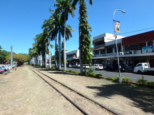
Narrow gage tracks used for bringing sugarcane to the mill at harvest time ran through Lautoka and alongside a lot of the roads. Some areas had rickety-looking train cars lined up near the tracks.

Apparently the people on our bus were on island time too because when given 15 minutes some waited longer to return to the bus. This was consistent at every stop, with some going double the given time. They added more people to the tour at that stop. Whether cruisers who had taken the shuttle to town or just other tourists I’m not sure, but they dropped them back at that stop before returning to the ship at the end. Speaking of the ship, the tour guide told anyone with their ship card hanging around their neck on a lanyard to put it away somewhere out of sight. Always a good plan in any port.

tropical flower

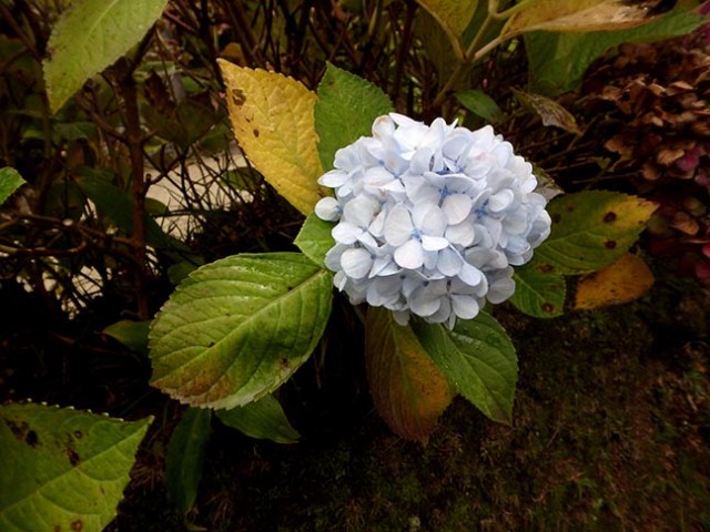
flower at the Garden of the Sleeping Giant

Along the way the tour guide said Fiji is multi-ethnic, but there’s only two races – the human race and the animal race. Although animals come in a multitude of species and humans don’t, the world would be a far better place with a lot less violence if everyone looked at things that way. No us and them, people are just people.

sleeping giant

the sleeping giant is a rock formation at the top of a small mountain

Our next stop was the Garden of the Sleeping Giant, up a long steep dirt road into the hills. The sleeping giant is a rock formation on top of the mountains. From certain views it looks as if it must be a lady giant. Up close you don’t really see it, but from our next stop on lower ground the giant in the rocks became far more obvious.

garden walkway

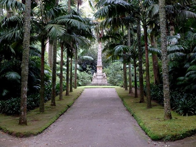
a wooden boardwalk trail ran through the Garden of the Sleeping Giant

People were given the option of paying a bit extra ($10) to go inside the garden or just sit in a covered area. They had a guided tour, but we were near the back. We tend to doddle around taking pictures. Other people cut in and we lost the guide. We ended up following the path until about 5 minutes until time to be back at the bus and then going back.

garden pond

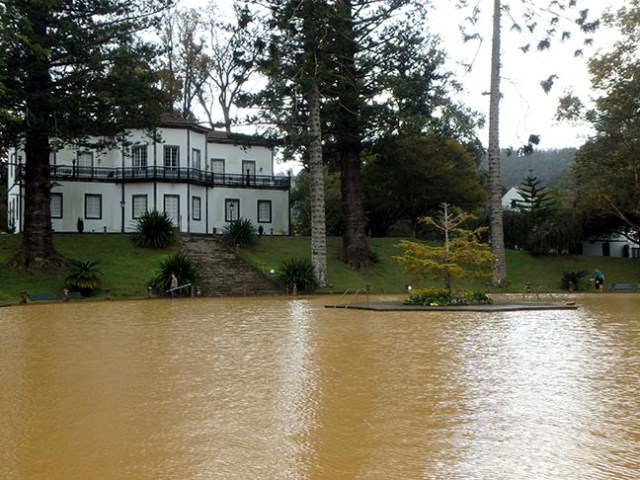
the pond in the Garden of the Sleeping Giant had fish in it

We would have liked for them to give us more time at that stop so we could go farther down the trail. The garden had lots of pretty flowers and other interesting plants. It even had a pond. We got back on time and were told to rest about 10 minutes before leaving. The guide came around and served everyone fresh tropical fruit juice made from several fruits they grow there. I don’t know what was in it, but it tasted good.

garden in Fiji

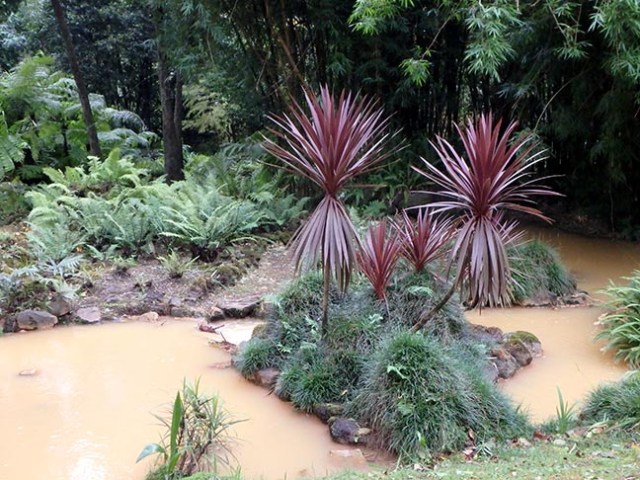
there were all sorts of different plants at the Garden of the Sleeping Giant

Fijians must not consider bathroom upkeep as much of a priority. The ladies room in the one at the garden had 3 stalls – 2 usable and the third full of ants. Everyone avoided the toilet that was akin to sitting on an anthill. People would rather wait in line than end up with ants in their pants. At a later stop (Smuggler’s Cove) with just one stall the bathroom needed cleaning and the toilet was clogged.

mud pool

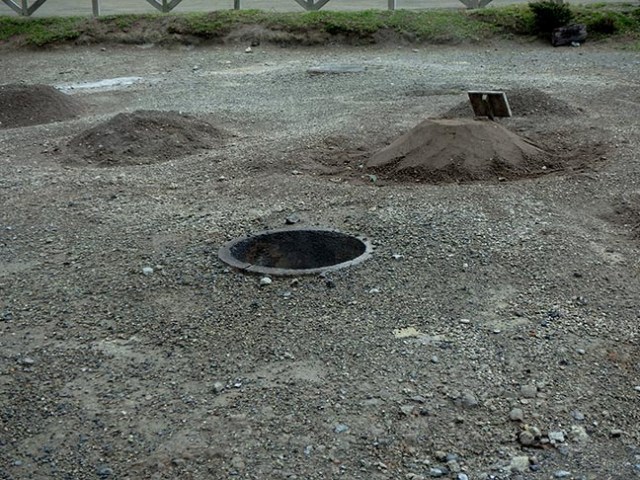
this guy got out of the mud pool just before we got there

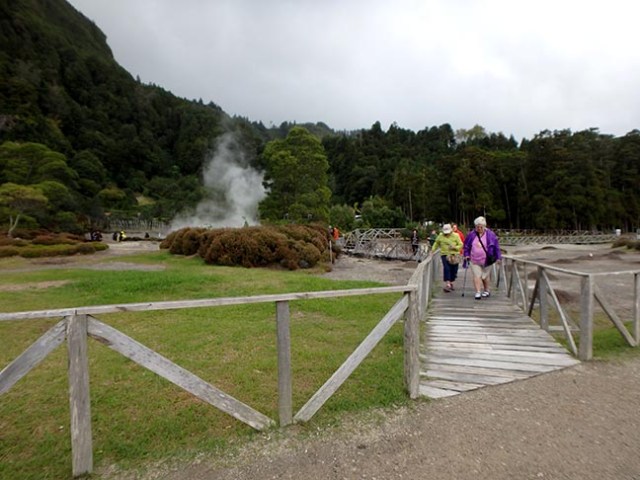
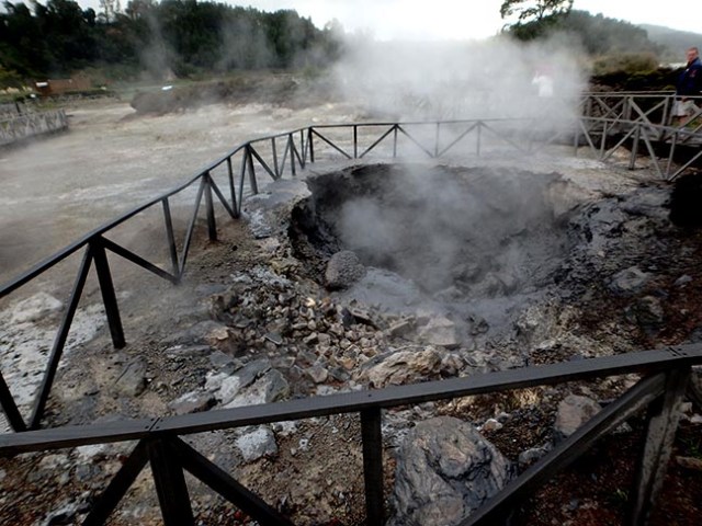
Not far from the Garden of the Sleeping Giant we stopped at Fiji’s Tifajek Natural Spa. From there the sleeping giant on top of the mountain definitely looked like a lady giant. Natural hot springs provide the hot water for mud baths, thermal pools, and a sauna. This stop also had a small fee ($5) to go in – more for anyone wanting to try the pools or have a massage. We ran into some people we knew from the ship who had gone there on a ship’s excursion. We were supposed to stay for 20 minutes, but actually spent 40 there. Most of that with everyone sitting on the bus waiting to leave except a couple people who decided at the last minute to get a massage instead of going back to the bus when it was time to leave.

massage hut

the natural spa had massage huts with floor mats as well as massage tables outside

We would have been happy if the tour ended at that point and took us back to the ship, but they still had a couple more stops on their itinerary. Next we went to Nadi, which our Fijian guide pronounced Nandi as if it had an N in the middle of the word. That’s where the airport is if you fly into Fiji. Mostly we just drove through the city. They did take a 15 minute stop at a gift shop, though about half the people didn’t bother to get off the bus. All these tours stop at specific shops where they must have some sort of business arrangement with the owners. You get the same thing on cruise ship tours, though not necessarily the same stores. 15 minutes of course stretched to about 25 before the guide managed to round up all the stragglers and herd them back to the bus. There always seems to be at least one inconsiderate person who never comes back on time on every tour. When time is short sometimes stops get missed because of them, and it’s never the shops that they skip.

Hindu Temple

Hindu Temple

We stopped briefly for photos at a Hindu temple which would have been pretty impressive if most of it hadn’t been draped under tarps for construction. Fiji has a lot of people who came from India. They own a lot of the shops.

Smuggler's Cove hotel

Outside seating at Smuggler’s Cove

Our last stop was a hotel called Smuggler’s Cove. It was on the beach on the windward side of the island. Drier, but not as calm of water. The hotel had a café and bar where some people had food or drinks. Just outside the door there was a small pool, which we never saw anybody go in. Beyond their outdoor seating was a sandy beach. A few people were out in the water, but not many. We were to be there for half an hour. During that time we saw a guy ride down the beach on a horse and come back riding that one and leading another. Later a car drove by on the beach. That stop stretched to about 45 minutes before they got everyone back to the bus.

Smuggler's Cove beach

beach at Smuggler’s Cove

This tour definitely ran on island time. The 3 hours we were told the tour would last ended up as 5-6 depending on whether you count time spent waiting for the bus to leave initially or time from when it actually left. Which could of course be looked at as getting more than our money’s worth since we were back well before all-aboard time or as running quite slow since a good percentage of that time was spent sitting on the bus waiting for people who couldn’t be bothered to come back when they were told to.

Copyright My Cruise Stories 2018
Posted in Explorer of the Seas, Pacific Ocean & Islands, Port Cities, Ports of Call, Royal Caribbean | Tagged , , , , , , , , , | 2 Comments

The Inside Upper Lower Accessible Cabin

Carnival Magic

Carnival Magic

Cruise ships have a variety not just of passenger cabins, but of accessible passenger cabins, and Carnival Magic is no exception. Whether accessible or not, rooms run the range from inside cabins to suites, and everything in between.

inside cabin sleeps 4

regular inside cabin with bunks has 2 lower beds that can go together for a queen

Prices vary among the same type of cabin depending on its location both in deck level and whether it is near the middle or out toward one of the ship’s ends. The very cheapest of the cheap, or lowest category of inside room is the ones designated as upper lower. By upper/lower they mean one actual single bed and one either bunk or couch bed. The traditional upper/lower has a drop-down bunk, but some ships have rooms with a couch that converts to a bed and one regular bed and these are also in that classification. These rooms are great for bargain hunters and solo cruisers. Usually they are fairly small rooms, but as with any category accessible rooms are normally larger than others in that category.

inside upper lower cabin

inside upper lower cabin 1340

When booking last minute for the Magic, my sister had a choice of inside room or suite. With suite well out of her budget that left inside room, of which her choices were accessible or not in the upper/lower category. Her travel agent said they would sell just one of the two available inside rooms as ships can’t exceed their lifeboat capacity and this one was nearly full. Depending on how many rooms have more than two guests booked some other rooms may go unsold and remain empty even when the ship is at full passenger capacity. Since they make more money on suites they’d rather an inside room was left open. Her travel agent advised picking the accessible room since it would be more spacious than the regular one.

cruise ship hallway

hallway in the cabin area on Carnival Magic

This room was located on the Lido deck and was of the traditional style with one bed and a drop-down bunk, which stays folded up fairly unobtrusively in the ceiling when not in use. The upper bunks have come a long way over time. Some older ships still have wall mounted bunks that stick out into the room even when folded up, while newer ones have ceiling bunks that fold completely into the ceiling leaving it just as flat as a room without bunks. On the magic the bunk folded up against the ceiling, but not into it. The room had lots of floor space since as a fully accessible room sometimes people have to maneuver a wheelchair around in there. Closet space was limited as the closet was smaller than average to fit in the space between the wall and the oversized bathroom door. The desk ended with space between it and the bathroom for wheelchair parking, making it smaller than average as well. So she got lots of floorspace and not so much storage.

cruise ship accessible cabin

shower in the accessible cabin

Floorspace wasn’t the only thing bigger than average though. While cruise ship bathrooms are usually pretty small, in the accessible rooms they are quite spacious. Instead of a lip around the shower it has drains for a roll-in shower, which is about double the size of those in regular cabins. There is also lots of floor space by the sink. The shower has a drop-down seat, and since it is oversized the clothesline is longer than normal.

accessible sink

sink in the accessible cabin bathroom

For one person this is a great room. Two would have space enough to move around, but might find the limited storage space a bit of a challenge if they brought much stuff, though if they had no wheelchair suitcases could sit in that space rather than getting stuffed under the bed making it easy to keep some things there. The bathroom would be no problem for two with more than the usual amount of counter space.

inside upper lower cabin

inside upper lower accessible room 11268

Overall she liked the room, except for lack of a chair until the steward brought her one of the sort normally found on balconies. The other drawback was that while proximity to the Lido made grabbing a snack or something to drink easy, it also meant hearing any late night deck parties making sleep impossible before the party ended. While the nightly movies seemed loud out on deck, she did not hear those in the room. These rooms can also be found on other decks.

Copyright My Cruise Stories 2018
Posted in Carnival, Magic | Tagged , , , , , , , | Leave a comment

Oosterdam Galley Tour

galley tour

one of the Oosterdam cooks busy preparing lunch

One sea day on Holland America Oosterdam the daily newsletter listing all the events for the day had a free galley tour on the schedule. It’s always fun to get a peek behind the scenes, especially when you can do it for free.

galley tour

everything has its own prep and cooking areas

We went to the scheduled meeting place in the dining room at the appropriate time and found a long line of people already there waiting for the door to open. I don’t know if anybody actually led this tour talking about the things people saw like they do on a far less crowded paid behind the scenes tour or not because we were far enough back in the line not to see or hear them if there was anybody there. I suppose somebody at least showed whoever was at the head of the line where to go.

cruise ship galley

the galley takes up a large area and food service employees are a good portion of the crew

The long line of people snaked through a set path through the galley where crew were busy with lunch preparations at all different stations.

galley tour

each prep or cooking station had dividers separating it from other prep or cooking areas

Cruise ship galleys have separate prep areas for each different sort of food so vegetables never become contaminated by meat or meat by fish or any other sort of cross contamination.

galley tour

bakery area

Baked goods have their own space too, and of course there’s a giant dishwasher for all the thousands of dishes used each day. Actually more than one and a place to wash pots too.

galley tour

rack of baked goods

Soups cook in giant vats. Feeding a couple thousand people takes a lot of soup. Of course there’s enough variety of food that not everyone on board eats the same thing, but there’s also enough people that whatever gets cooked a lot of people will want it.

galley tour

dessert station

Desserts are an important part of cruise ship meals so of course there are areas for them too.

galley tour

how to plate things

The walls in the main walkway had all sorts of things posted regarding the menus and how to plate various dishes.

galley tour

new menu

There were big signs posted on the wall showing photos of how each of the dishes on the menu should look. Next to the current menu there was also one showing food for Mexican itineraries, as that was where the ship would go next when it finished the Alaska season.

galley tour

names of crazy plates and instructions for dessert service in the Pinnacle Grill

Next to the menu pictures another sign showed photos of some crazy looking plates, which said they were for the tour.

decorative cruise ship plates

table in the Pinnacle Grill set with crazy plates for the tour

The tour ended with a walk through the Pinnacle Grill, Holland America’s fancy upscale pay-extra eatery. There set out on some of the tables were those crazy looking plates.

cruise ship galley

preparing veggies for lunch

Copyright My Cruise Stories 2018
Posted in Holland America, Oosterdam, Shipboard Life | Tagged , , , , , , , | Leave a comment

Ponta Delgada, Azores

Carnival Vista in Ponta Delgada, Azores

Vista in Ponta Delgada, Azores

Following a couple stormy days at sea between Gibraltar and the Azores, Carnival Vista docked in Ponta Delgada on a day with a weather forecast of cloudy with 20% chance of rain and a high of 69 degrees Fahrenheit. Once again we got to the meeting place barely too late to get stickers for the first bus on our tour and had to wait for all the stragglers to show up for the second one to get called. Eventually they all made it to the lounge and then onto the bus. Our tour was to take us to Furnas Valley to see the geothermal activity – hot springs, mud pools and geysers the excursion description said, bringing up a mental picture of some sort of miniature Yellowstone.

geothermal cooking

cooking mounds and an open hole

Sao Miguel Island has a volcanic crater with two lakes, one green and one blue. Since the deep blue comes from the reflection of the sky that one may have looked more gray that day, but I can’t say for sure since we didn’t go there. The green one gets its color from the dense vegetation on the crater walls. The bus drove along the shore of the green lake while the guide explained how people living there had used the crater’s geothermal activity as a means of cooking for centuries.

hot spring in the Azores

pathway to the hot spring

While they originally just buried their pans of food in the dirt, they now have cement lined holes throughout an area with boiling hot springs and mud pools to put the food pans in before burying them. They leave the mixture of meats and vegetables in the ground for about 5-7 hours before unearthing it ready to serve. The ship did offer tours that included a meal from one of those in-ground pots, but ours wasn’t one of them.

pathway around a hot spring

steaming crater

A boardwalk winds past dirt mounds with food inside, open cement holes ready for cooking, and an open boiling pool of water. Just beyond the water pool the path passes by a pool shrouded in steam. Occasionally the steam clears enough to see it throw boiling hot mud.

hot spring

boiling water bubbling out of the ground

While we wandered about it started to rain. Some people pulled out their raincoats or umbrellas at the first drop, but I’ve always lived in a rainy state and can’t be bothered to worry about a little bit of rain.

friendly ducks

these ducks walked up and sat down at our feet hoping for a handout

I got a bit wet taking photos of some half-grown ducklings who came up hoping for a handout, but it dried before the next stop. Unfortunately the next stop was not geysers or anything of the sort, that first stop apparently being all the natural geothermal features we would get to see.

hydrangea

roadside hydrangea

We didn’t see any litter along the roadsides. Our guide said that people were paid to keep the roadside plants trimmed and streets clean. Hydrangeas and ginger lilies grow abundantly along the roadsides, neither native with the hydrangeas planted and the lilies invasive. We were a bit past the season for flowers with the lilies just in greenery and the hydrangeas mostly sporting dead blooms, though a few still had vibrant blue or white flowers.

Terra Nostra Gardens, Azores

statue at the end of a pathway in Terra Nostra Gardens

Our next and longest stop was at Terra Nostra Gardens. Once a private garden, it is now a park. It has plants and trees from around the world and hot springs running through the park and feeding the park’s pool and hot tubs.

hot spring pool

not a pool I would want to swim in

We didn’t see the hot tubs, but the muddy brown color of the pool seemed very uninviting and the hot stream flowing through the park looked just as brown.

looks like a river of poo, but it's just water

muddy hot stream

There was a pond and stream with clearer water, but that must also have been colder since it was full of coy (big goldfish.) If you stand at the edge of the pond all the fish swim to you hoping for food.

Terra Nostra Gardens

coy pond

Our map of the park mentioned grottos and a boiling lake as the features we thought we’d find most interesting. We found a lake, but unless you count raindrops hitting the surface it didn’t have any activity resembling anything boiling so it probably wasn’t the one we were looking for.

garden grotto

grotto under the bridge

Some caves under a sort of bridge to nowhere may or may not have been the grotto. By bridge to nowhere I mean it looked like a bridge below, but on top was just a platform with no path to either end.

plant animals

topiary

We found the topiary without looking for it, though like most other things it appeared out of season as the animal shapes were not entirely covered with greenery. Up a hill from there we found an ancient stone gazebo and some sort of statue down a trail. And of course all sorts of plants, though not many flowering in late October.

lake in a crater

green lake

Next we went up to the top of the mountain. I had thought people were supposed to be able to see both the blue and green lakes at once, but either I was mistaken on that or we were not in the right place for that view because we could only see the green one. We weren’t there long before the clouds thickened and the view became obscured in the mist. Luckily it was a short stop as the wind kicked up fiercely just about the time we were to board the bus. The bus parked next to a makeshift souvenir stand where the last passenger couldn’t find her husband to get money for her purchase until the guide asked if he was on the bus. Everyone was on the bus except her so he had to get off and when she loudly yelled that she had been looking all over for him and what was he doing on the bus everyone started to laugh since we all heard through the open doors. Finally she made her purchase and got on.

Riberia Grande, Sao Miguel Island

Riberia Grande

Our last stop was in the town of Riberia Grande, the oldest town on the island. Our guide said it once was filled with colorful homes, but when people started going for vibrant colors rather than pale the governor raised taxes on houses with color so for years everything became white or gray. She said just recently color was beginning to come back to some of the buildings. The bus stopped near an old church that is used only for special occasions now.

historic church

old church in Riberia Grande

The former monastery of the church is no longer in use, a fact made obvious by the large hole in the roof. A bridge crosses over the river that gives the town its name. On European excursions there always seems to be a place people are led to by guides who seem to have some sort of connection with the store. In this case it was a liquor store where they had free samples of various liqueurs made on the island. Flavors included pineapple, tangerine, passion fruit and chocolate.

riverside homes

houses by the river in Riberia Grande

Oranges were once an important crop on Sao Miguel, but when disease took out most of the orange trees they switched to other crops. The island mainly produces meat and dairy products now, but still has some crops including pineapples and tea. Some things like sugar and tobacco are grown only for use in the Azores because Portugal has restrictions on what they can export.

Azores

Terra Nostra Gardens

We did see some interesting things and learn something about the area, but overall the excursion was somewhat disappointing since we booked it expecting to see more impressive geothermal features. People might find more satisfaction in cruise ship excursions if the descriptions given were accurate rather than exaggerated as they often are.

Copyright My Cruise Stories 2018


Posted in Atlantic Ocean & Islands, Carnival, Europe, Ports of Call, Shore Excursions, Vista | Tagged , , , , , , | 2 Comments

Things to Do on Holland America Veendam

Holland America Veendam

Veendam in Costa Maya, Mexico

Cruise ships vary greatly in size as well as in options of things to do onboard. While some of the bigger ships have things like waterslides, rock climbing walls, flow riders, or even ziplines, skating rinks, or racetracks, smaller ships without those adornments have things to do as well. When choosing a ship to cruise on it always helps to plan according to who is cruising with you and what they like to do. For instance when cruising with the grandkids we always pick a ship with things like waterslides, but when they are not along we often pay more attention to the destinations than the ship’s amenities.

Veendam hot tub

hot tub and pool on the Veendam

Holland America’s Veendam is a smaller, quieter ship. It often has great destinations which is why I’ve sailed on it twice – once on a Canada/New England cruise and more recently on a Caribbean cruise with a port stop in Cuba. Both of these were 7-day cruises with lots of port stops, but even on short port-heavy cruises there’s always some time at sea to enjoy what the ship has to offer.

cruise ship pool

the main pool on the Veendam has a retractable roof

The Veendam has two swimming pools and several hot tubs. Other ways for guests to amuse themselves include a giant chess set, ping pong tables, a giant connect 4 game, a tennis court, and a basketball court. There’s also lots of deck chairs for people to relax in.

giant chess on a cruise ship

giant chess set

The ship has plenty of things to do indoors as well. Of course it has bars and a casino. They also have daily movies in one of the onboard theaters, and a long list of movies available that people can have brought to their cabin at no charge. There are board games and puzzles in the Explorations Café, and afternoon tea served daily in the dining room.

cooking demonstration

America’s Test Kitchen demonstration on Holland America Veendam

While all ships have activities scheduled daily, the smaller ones without as many ways for people to amuse themselves rely more on activities and schedule accordingly. Besides the usual things like trivia and other contests, Holland America’s ships have Digital Workshop computer classes sponsored by Microsoft and cooking demonstrations by America’s Test Kitchen. Some of their other special activities include BBC Earth experiences, O Oprah the Magazine activities, and Explorations Central lectures.

Veendam bar

bars on the Veendam

There’s something for everyone with fitness classes at the gym as well as yoga and morning stretch exercise classes. There’s also lectures and port talks, bridge games, bingo games, and of course nightly shows in the main theatre. Other evening entertainment includes the music walk, with several centrally located bars featuring nightly music.

Veendam basketball court

basketball court on the Veendam

Veendam also has places where people can sit near a window and read, play cards, or just enjoy the view. The promenade deck goes all the way around the ship for outdoor walks, though jogging is not allowed on this ship’s promenade – probably due to there being staterooms on the promenade deck with direct outside access.

cruise ship theater

main theater on the Veendam

As with all ships, the amount of activities people want to join is completely up to them. Kind of like the amount they want to eat, because on a cruise ship food is always plentiful.

Copyright My Cruise Stories 2018


Posted in Holland America, Shipboard Life, Veendam | Tagged , , , , , , , | 4 Comments

Fiji Cruise Ship Ports

Lautoka Fiji cruise ship dock

Explorer of the Seas in Lautoka, Fiji

Officially known as the Republic of Fiji, this south pacific island nation consists of over 300 predominantly volcanic islands plus another 500+ smaller islets, mostly uninhabited. 87% of the population lives on the two largest islands, Viti Levu and Vanua Levu. About 3/4 of those live on the coasts of Viti Levu, which is also the island with both Fijian cruise ports we visited. We had one port stop in Suvu and the other Lautoka. Lautoka is sugarcane country while Suva is the capital and Fiji’s main cruise port. Nadi with its international airport is found on Viti Levu and has lots of resorts due to the proximity of the airport. Tourists also flock to the Mamanucas islands near to Nadi. Tourism, tapioca and sugarcane are currently Fiji’s main sources of income.

Fiji

map of Fiji from Wikipedia

Historically the inhabitants of Fiji were cannibals, but not anymore. Fiji has a tropical marine climate with the warmest months from November to April and coolest from May to October, though with a 72 degree F average temperature for the cooler months they aren’t exactly cold. Rainfall is heaviest during the warmer months. Cyclones hit about once a year.

Fijian beach

beach near Lautoka, Fiji

Sandy beaches, coral reefs, tropical weather, and islands with crystal clear water are the main tourist attractions. Currency is the Fijian dollar, but American and Australian dollars are widely accepted there as well.

ship view of Suva

view of Suva from a cruise ship

Fiji’s largest city, Suva, is a metropolitan area with restaurants, shopping, museums, parks, gardens, historic buildings and nightlife. Lautoka is the second largest city. Its main employer is a sugar mill. Lautoka has markets, uncrowded beaches, and an international selection of restaurants.

Lautoka Cruise Ship Port

Mainly a container port, Lautoka gets about 4 cruise ships a month. Fijian music and dancers greet the cruise ship on arrival. Look for them from the ship because they stopped as soon as passengers began to disembark. They performed again late in the day while a line of people waited to board, bringing some of the crowd in to dance with them. A tip jar sat nearby in hopes passengers had not spent all their money on shore and had a bit to spare for the entertainment.

dancers in Fiji

dancers on the dock greet arriving ships

There was a line of booths set up across from the gangway. At the end closest to the ship they all offered same day tours. Most had an island tour in a bus or a boat tour to another island for beaches and snorkeling. Standard prices in Australian dollars ran fairly close to the same from one booth to another, though some had better discounts for American currency than others. At some the price was set, but others were open to haggling for a slightly better deal. Some of these booths also offered things like massages and hair braiding.

Lautoka cruise ship dock

booths at the dock by the ship in Lautoka, Fiji

At the other end of the line the booths had a variety of things for sale. Beyond that there was a booth next to the ship for people on ship’s excursions to gather in.

Lautoka, Fiji

Lautoka near the shuttle and tour bus stop

Pre-cruise research online came up with different sites saying town was ½ mile, 1.4K (which is nearly a mile), 2.5 miles, and 4 miles away. The shortest estimate was probably to the edge of town where it looked like some sort of flea market going on in a field with lots of different booths. The shuttle stop was a bit farther in, near lots of stores. Probably closer to a mile or two. 4 miles was definitely an overestimate.

sugarcane train tracks

narrow-gauge railroad tracks run through Lautoka to take sugarcane to the mill

Our ship sold shuttle tickets into town at $9 for the day. They pushed for people to buy them in advance so they wouldn’t have to wait in line on port day. Of course anyone buying shuttle tickets in advance would be out that money if they decided to take a tour instead of just going to town. Cruise ship excursions and tours booked at the booths in the port all left right from the port with no need for a shuttle to town. The shuttles would mainly be useful for people who just wanted to shop or stay near the port. The tour bus did add some people at the first stop in the shopping area where the shuttles stop, but unless they wanted extra shopping time those people could have saved money by taking the tour straight from the port since they wouldn’t have had to pay for the shuttle to town as well as the tour that way.

fiji sugar mill

sugar mill in Lautoka

There’s a sugar mill quite near the port. Many places used to grow sugar cane. Fiji still does. Narrow-gage railroad tracks parallel the road throughout much of the island for bringing sugar cane to the mill at harvest time. Sugar is not the mainstay of Fiji’s economy it once was having been overshadowed by tourism and tapioca, but it is still an important crop.

cruise dock in Suva

photo of a welcoming warehouse from a ship docked in Suva

Suva Cruise Ship Port

Fiji doesn’t see enough cruise ships to build terminals especially for them so even in Suva cruise ships dock in a container port, this fact only made more obvious when getting funneled through a warehouse between the gangway and port exit.

cruise ship dock in Suva

booths at the Suva cruise dock

Like Lautoka, Suva had a number of booths set up on the dock selling sightseeing tours and transportation to beaches. The sightseeing tours normally include a stop in a local village, but on Sunday all the villagers go to church so if your port stop is on Sunday with a last minute tour you miss out on things like firewalking and Kava ceremonies that happen there. Which means if you find the right provider you can negotiate a better price. Missing out on the Kava could be a bonus though. We tried that local drink at a Fijian village next to a resort we stayed in once and it’s definitely something I’m happy to do without. Ship’s tours still included a village visit.

It’s just a 5 or 10 minute walk to town from the dock in Suva.

Copyright My Cruise Stories 2018


Posted in Explorer of the Seas, Pacific Ocean & Islands, Port Cities, Ports of Call, Royal Caribbean | Tagged , , , , , , , , | 7 Comments

Paradise Point Skyride in Saint Thomas

Saint Thomas

Paradise Point Skyride

After having looked up the weather before our Carnival Magic cruise and seeing a prediction of rain for all four ports, we were quite happy to see sunshine in the forecast when time for the actual cruise came. Our second port was Charlotte Amalie on Saint Thomas, US Virgin Islands – a place we had visited once before. On that visit we took an island tour and then a quick trip to Paradise Point on the skyride before going back to the ship. At that time we saw a ferris wheel, a trail, and all sorts of animals at the top in addition to the shops and restaurant.

Saint Thomas skyride

lower tram station

Traveling with a group of 9 this time, we thought walking to the skyride and taking a trip to the top would make a fun day for all since there was quite a bit to do up there. The lower tram station is a short walk from the cruise ship dock. We bought tickets on the ship, which cost a bit less than buying them at the ride. On the way there we noticed the mountain top looking freshly dug up. Several taxi drivers stopped in hopes of getting us to take a ride to the top with them. They said driving a carload of people to the top costs about the same as one skyride ticket. They all said the cablecar down was still free.

going to Paradise Point

skyride over the new road

We’d already bought tickets and took the skyride up. Even if we hadn’t already had tickets the whole point was riding in the gondolas rather than getting to the top and there’s nothing special about riding in a car. The road to the top all the taxi drivers mentioned hadn’t been there on our previous visit. People had to walk up or use the skyride then.

skyride top station

top station with new road and bare hill

That wasn’t the only change. Everything that had been above the skyride on our last visit was gone. No viewpoint, trails, or animals. The place where the ferris wheel once sat off to the side and a bit below the upper tram station was just an empty concrete slab. It seems someone was more interested in bringing customers to the restaurant and shops than in providing any sort of entertainment for visitors – which translates to less reasons to bring a family up there.

authentic shipwreck merchandise

shipwreck salvage for sale

We looked around the shops a bit and thought the one selling stuff from shipwrecks was the most interesting. In one shop a teenage boy accidently knocked a rather expensive Christmas ornament off a shelf and broke it. His parents had to pay for it. Luckily none of the kids in our group broke anything.

restaurant at Paradise Point

restaurant view from the skyride

The open-sided restaurant had a patio area extending beyond the roofed part. We walked to the far end to see the view off the terrace. The views are still spectacular up there and there’s plenty to eat and drink. Other than that there wasn’t much to do so we would have looked elsewhere for a way to entertain youngsters if we had known all the other things were gone.

Paradise Point Skyride

skyride coming up to the top station

There seemed to be more shops down on the level below where the skyride stops this time, though I may have just missed them last time since we hurried back in a downpour after checking out the things that no longer exist and didn’t look around the shop and restaurant area much that time.

skyride view

inside the skyride

Saint Thomas has lots of shops and places to eat near the cruise terminal, but there isn’t much else to do there without taking some sort of transportation to get elsewhere – which is available at the port.

Paradise Point, Saint Thomas

view of skyride, cruise port, ships, and beyond from Paradise Point

Most of the ship’s excursions on Saint Thomas involve water sports or beaches, but there are a few other things like scenic drives, a zip line, or an ice bar.

2017’s Hurricanes Irma and Maria caused extensive damage to the tram, buildings, and road. It stayed closed for several months for repairs which included all new cables and is back up and running again.

More Blogs About Saint Thomas

Saint Thomas, US Virgin Islands

Paradise Point Skyride

Random Bus Tour on Saint Thomas

Posted in Caribbean, Carnival, Magic, Port Cities, Ports of Call | Tagged , , , , , , , , , , , , , | 5 Comments

Ketchikan Cruise Ship Port

Ketchikan, Alaska

Ketchikan, Alaska

Ketchikan photo taken from a cruise ship

Ketchikan lies on Revillagigedo Island at the southernmost entrance to Alaska’s scenic inside passage surrounded by the Tongass National Forest. This temperate rainforest lives up to its designation. Ketchikan averages around 140-160 inches of rainfall annually, with the heaviest precipitation in the fall and winter. Ketchikan is rich in fish and native artwork and culture. It has lots of totem poles with some around town and some in parks. The town’s name comes from the Tlingit native word for Ketchikan Creek, Kitschk-hin.

Ketchikan cruise ship docks

map of downtown Ketchikan showing all 4 cruise ship berths

Ketchikan has 4 cruise ship berths. 3 of them sit on the edge of the main touristy part of town and the fourth a short distance away with shuttles for those who don’t want to walk to town from there. There’s a visitor’s center right on the main cruise ship dock where anyone who didn’t pre-arrange shore excursions can find a variety of things to do. Streets near the docks are full of tourist oriented shops and it’s a short walk from the main docks to Ketchikan’s famous Creek Street.

Dolly's House on Creek Street

Dolly’s House on Creek Street in Ketchikan, Alaska

Creek Street has its own history. This creekside walkway with over-water buildings was once the town’s red light district. Most of the former houses of prostitution are tourist shops now, though one remains intact as it was decades ago in the form of the Dolly’s House Museum.  There’s a funicular to ride up to a hotel above Creek Street, or hike up on the Married Man’s Trail – the place where married men of the past snuck unseen to the  brothels.

map of Ketchikan

Ketchikan Walking Tour Map

Ketchikan has lots to do. You can go fishing, or take a ride on a boat once featured on the TV show Deadliest Catch. Flightseeing, ziplining, and even snorkeling are options. Inexpensive tours are available by trolley, horse carriage, or even amphibious Duck vehicles. Ketchikan also has museums, parks, and native cultural areas. Excursions can be booked in advance through your ship or through outside sources. There are also quite a variety of things available last minute at the visitor’s center or sometimes from people with signs on the dock. Or just take a walk and explore.

sea urchin

snorkel Alaska shore excursion

Cruise ship excursions offered in Ketchikan include off-roading in adventure carts or jeeps, flightseeing, raptor center, wildlife adventures, fishing, canoeing or zodiacs, zip line, Bering Sea crab boat, Trolley tour, duck tour, totem poles, bear viewing adventure, cultural experiences, snorkeling, zip line, rainforest hike, lumberjack show, crab feast, and a wildlife boat safari. Excursions offered vary from ship to ship, but usually include the major attractions.

Duck amphibious vehicle

Ketchikan Duck tour goes on land and in the water

More Blogs About Ketchikan

Duck Tour, Dolly’s House, Trolley Tour, Rainforest Hike, Walking Tour, Snorkel Alaska

Posted in Alaska, Holland America, Oosterdam, Port Cities, USA | Tagged , , , , , , | 4 Comments

San Antonio Texas

Texas map

map of Texas

You won’t find ocean cruise ships in landlocked San Antonio, Texas, but you can take a cruise there. We’ll get to that later in this post. San Antonio has interesting and historical things to see making it worth a side trip when in Texas for other reasons, or as an add-on to a cruise. It’s nearly 250 miles from Galveston (where you can find ocean going cruise ships) to San Antonio, or roughly a 4-hour drive. Closer to 3 hours from Houston, where people cruising out of Galveston are likely to fly to.

Alamo church

the iconic church at the Alamo

While most of the USA either broke free from England in the Revolutionary War or was settled afterword, Texas has it’s own unique history. It started out as a colony of Spain, then became part of Mexico at their independence. Texas broke away from Mexico and for nearly a decade operated as its own country – the Republic of Texas – before joining the USA. At the same time the battle resulting in the famous “Remember the Alamo” was happening in San Antonio (Feb 23-March 6 1836), a convention of Texans at Washington on the Brazos near Houston signed their Declaration of Independence (March 2-3 1836). American Legend Davy Crockett died in the defeat at the Alamo to Mexico’s President Antonio Lopez de Santa Anna. The greatly outnumbered Texans killed about 3 times more Mexicans than the total number of people inside the Alamo before the Mexican army breached the old mission-turned-fort’s walls and left everyone except a few women and children and one male slave dead. Even back in the 1800’s with no airplanes or modern technology walls were not an effective means of protection – and those heavily guarded walls were fortified with cannons.

Alamo gift shop

gift shop at the Alamo built in 1936 to commemorate 100 years

Sam Houston’s army defeated Santa Anna shortly after in the Battle of San Jacinto, a short (18-minute) battle fought on April 21 1836. The Treaty of Velasco signed May 14 1836 officially gave Texas their independence, but Mexico refused to accept the treaty due to Santa Anna being a captive at the time of signing. This led to border wars that continued after Texas became a state, culminating in the Mexican-American war in 1846-1848. The Republic of Texas included all of present-day Texas as well as parts of New Mexico, Oklahoma, Colorado, Kansas, and Wyoming.

the Alamo

The Alamo in 1836

The Alamo was originally a Catholic mission intended for converting the native population. The mission was abandoned for 10 years, during which time parts of it crumbled to ruins before being converted to a fort while a town sprung up on the other side of the nearby river.

prickly pear in bloom

prickly pear cactus in bloom at the Alamo

The iconic church that symbolizes the Alamo was roofless at the time of the infamous battle. Only a small portion of the Alamo’s original complex remains, with just parts of the current structures as original construction. It’s free to go inside. There are displays inside the church (which has a roof now) and in the Long Barrack, which is the other partly original building. They have about a 20-minute historical video and a newer building built in 1936 houses a gift shop.

Alamo cat

a calico cat makes herself at home at the Alamo

Pathways wind between plantings throughout the grounds. Some of the gardens contain large oak trees or giant prickly pear cactus, which were in bloom during our visit. Brightly colored giant coy swim about a cement-lined creek. We also saw a calico cat sunning herself on the pathway near the fish. She had a collar and license on which meant she belonged to someone, but we were not sure if she lived at the Alamo on mouse patrol or had wandered in from a nearby apartment.

horse carriage

horse carriage ride in San Antonio

Near the Alamo we saw quite a number of white horse-drawn carriages all decorated up with lights making them suitable for wedding transportation sitting along the roadside waiting for passengers. Most had white horses between the shafts. We didn’t have a lot of time before the Alamo closed at 5:30 and the price for a carriage ride was more than we cared to spend so we passed on taking a ride.

manmade river leading to the River Walk

walkway into the Hyatt Hotel

Across the street from the Alamo a stairway leads to the lower level of the Hyatt Hotel. A fountain starting by the stairway flows into a manmade river which runs through the hotel, ending with a bit of glass separating it from the beginning of the real river and another San Antonio attraction – the River Walk. Just follow the hotel’s river inside and when you exit the door at the other end you’re there. Walking on the River Walk is free, but of course it costs money if you want to buy anything at the shops, eat at one of the many restaurants, take a river boat ride, or have a drink at a bar.

San Antonio River Walk

River Walk pathway leading under a road

San Antonio’s River Walk runs underneath the main streets through town. Most of it follows the natural path of the river, though it does have some manmade additions. The River Walk is clever usage of the above ground portion of a flood control system which incudes a series of dams and some underground pipes working to keep the water level constant. The loop through town is surrounded by hotels, shops and restaurants.

River Walk cruise

San Antonio is not by the ocean, but you can still take a cruise! River boats cruise the River Walk loop.

Open boats provide inexpensive short cruises around the loop with narration from the ship’s captain about the area and its history. People can choose to cruise by daylight or wait until after dark and cruise under the lights of the buildings. The boats are lit up at night with colors that vary from one boat to the next. Some boats even do dinner cruises where people can dine while they float along with an ever-changing river view.

river walk dam

flood gate dam in San Antonio’s River Walk

Leaving the loop the walk along the river extends in both directions for those who want a less-crowded walk. We walked out to one of the dams where the water drops to a much lower level. There’s quite a large underground boat docking area on the opposite side of the river, but the boats could go no farther downstream past the dam due to the large drop.

ducks

ducks in the river

The loop area of the River Walk has some ducks. Mostly they swim around in the river, but one did come up to the pathway and walk with us for a bit. We also saw some begging for food near some of the restaurants, but they did not look aggressive and none came near our table when we had dinner at the oldest Mexican restaurant on the River Walk. Many of them are black and white, a coloring I had not seen on ducks before though it was common there.

San Antonio River Walk

water feature on the River Walk

Pathways extend along both sides of the river throughout the populated area, with numerous bridges along the way and sometimes waterfalls or fountains. We took a riverboat ride after dark and though we did not see anyone fall in the water, the boat captain said if anyone did all they needed to do was stand up as it was rarely deeper than 4 feet. He said generally about one person a day falls in. With all the bars around you might think it is due to drinking, but he said it’s actually texting and walking that causes most of the dunkings.

river walk in San Antonio

bridge across the River Walk

We found a B&B a short distance away from the downtown area for just $25 a night so accommodations can be had there  for quite a reasonable price. Parking near the Alamo can get a bit pricey though at $10-$20 for the day depending on the length of stay.

Copyright My Cruise Stories 2018
Posted in Day Trips, Randoms, USA | Tagged , , , , , , | 1 Comment

The Rock of Gibraltar

Gibraltar

Gibraltar cruise port

Carnival Vista – photo taken from the Rock of Gibraltar

We got off the Carnival Vista in Gibraltar expecting to make our way to the Gibraltar cable car, ride it to the top, and then walk down where we would see the siege tunnels, monkeys, and cave on the way back down. Exiting the ship through the port area we found taxi vans offering tours to the rock, and (for a higher fee) beyond. The information desk said it was about a 20 minute walk into town and about 45 minutes walk to the bottom of the cableway. There were taxis willing to take people to town, but we couldn’t find one that would go all the way to the cable station so we set out on foot.

Rock of Gibraltar

most of Gibraltar is the rock

In town we found a bus station where you could get an all day pass for very little money. Being a British colony the official money in Gibralter is the British pound, but since Gibralter is just a little point of land attached to Spain they are just as happy to take euros. We were able to save some time by taking the bus to the cable car station rather than walking.

unusual runway

Runway with the road from Spain to Gibraltar passing through it

While the rock dominates any view of Gibralter as well as a large amount of its small land mass, its other notable feature comes in the form of a runway which runs the length of the boarder with Spain – and beyond as it juts out into the water with nothing else around it on one end. This runway is quite unusual in that the road from Spain to Gibralter runs through it and has to be shut down any time a plane takes off or lands.

cable car in Gibraltar

Gibraltar Cable Car

When we got to the lower cable station one cable car was on its way down. Before we even got inside to buy tickets all the people who had been waiting there came out saying it was closed due to the wind. Apparently the car coming down just had someone on it who worked there testing out the weather. He decided it was not safe to run so that was no longer an option for getting to the top. An empty taxi van went by so we hailed it, followed by way more people than it had room for, though one extra couple tagged along with our group of 5, which included 3 friends from the ship as well as us. More taxis came up behind ours so they must have got word that the cablecar wouldn’t run that day.

airplane on runway

runway view from the ship – with an airplane on it

The taxi van offered the same tour of the rock that we could have gotten at the port. It’s only an hour and a half tour. We wanted more time to see everything which is one reason we would have liked to take the cable car up and walk down. Since that was no longer an option we took the taxi. Some people do walk up, but it’s a long steep walk and for some in our group the walk down would have been a challenge and walking up out of the question. With the cable car closed for the day the taxi was our best bet.

old cannon

cannon near the entrance to the siege tunnels

Our taxi driver said that Gibraltar has more jobs than people to fill them so thousands come over from Spain each day to work. The per capita income average in Gibraltar is nearly twice that of Spain. Like Malta, in Gibraltar we saw none of the graffiti, litter, homeless people, beggars or stray animals found in most places of the world.

cave in Gibraltar

entering Saint Michael’s Cave

We made a brief stop partway up where you can see Africa (Morocco) just 14 miles away across a channel, but it was pretty hazy in cloud cover so not a great view that day.  Then we went inside St Michael’s Cave. It’s a huge natural limestone cavern with lots of impressive stalactites and a whole network of caves.

colored light on cave formations

stalactites in green light

There are lights in ever-changing colors shining on the rock formations so you don’t see the true natural beauty of the cave. Some colors turn out better in photos than others. With my camera the rock formations came out clearer in blues and greens than in pinks and purples. Perhaps if we had more time to explore we could have found a more natural looking area. There was a stairway going down deeper into the cave, but we didn’t have time to go there due to the taxi tour’s time limit. I may have been the only one in our group who would have liked to explore further anyway. My kids and I are into caves, my husband and the friends we were with that day not so much. If either of the kids had been there I’d have had someone to take the option to bail from the taxi at the top and walk down the rock with, but nobody else in our group that day wanted to.

colored light on stalactites

cave in artificial light colors

The cave was created by rainwater seeping through the limestone, gradually dissolving the rock over thousands of years. It also has a lot of human made additions. Besides the pathways and lights that change colors over the cave walls, it has an area with seats for concerts sometimes held there to take advantage of the natural acoustics of the cave.

St. Michael's Cave

concert hall in a cave

Sometimes monkeys hang around near the cave exit, but sensing an impending storm none were there that day. The building where you enter has a restaurant, gift shop, and free bathrooms. In Europe a lot of public bathrooms charge a fee to get in so it’s always nice to find a free one.

Barbary apes of Gibraltar

mama monkey and her baby

Our driver said the monkeys are descendants of Barbary apes brought over from Africa  decades ago. They keep the different family groups from foraging too far and fighting over territory by adding fruit to their diet and feeding each group in separate areas so they stay in their own space. As we approached a monkey feeding area the driver panicked over a passenger opening a granola bar and told her to put it away or we’d have monkeys in the van. They are a species of macaque from Morocco.

Gibraltar ape

Barbary ape at a feeding station on the Rock of Gibraltar

Feeding stations alongside the road on the way up to the siege tunnels attracted a large group of monkeys. Some were in the feeding area eating the fruit there, others sat on the roadside or climbed outcroppings of rock. Several babies ran and jumped from tree to tree in the bushes growing at the top of the rocks towering over the roadway.

monkey on a van

monkeys on taxis

A row of taxis stopped and let people out for monkey photos and to climb a stairway to a viewpoint. Some monkeys hopped on top of the barely moving vans. As each van worked its way to the front of the line the people got back in and it moved on. Passengers had to stay aware of where their van was in the line so they would return when it got to the front and not stuff up the line. Besides food, Gibraltar also provides veterinary care for its wild monkeys.

siege tunnel view

view through an opening in a siege tunnel

Near the siege tunnels tour busses stopped at a parking area down the hill a ways from the entrance and let people out to walk up. Taxis go right up to the building with the entry, but have to work their way through the oblivious bus crowd walking up the hill to get there. Outside the tunnels there’s a great view of the runway and Spain on the other side. If a plane lands or takes off while you are up there you can watch it from above. Kind of an odd feeling standing on solid ground looking down on a flying jet.

siege tunnel

inside the siege tunnel

It took 5 weeks to dig the siege tunnels 82 feet into the rock by hand and gunpowder for the Great Siege War from 1779-1783 when France and Spain tried to take over Gibraltar. By the end of the siege the tunnel extended 370 feet. They have windows along the outer wall of the rock which were initially made for ventilation, but soon adapted for firing cannons. These upper tunnels are open for the public to tour as the Great Siege tunnels. After the siege ended they kept on tunneling adding several chambers. During World War 2 it took just a week to add another 180 feet using mechanized tunneling equipment and explosives. Throughout the war they added many more miles of tunnels. Which is pretty amazing since the whole of Gibraltar is only about 2.6 square miles. More tunnels and storage areas were added during the cold war with tunneling finally ending at a total of about 34 miles in 1968. Gibraltar has about twice as many miles worth of tunnels through the rock as it has in total roads. Some mid-level tunnels are open for tours as WW2 tunnels, but the unmaintained lower tunnels are off limits to the public. Some crumbling tunnels have been permanently sealed off for being unsafe.

roaside on the rock of Gibraltar

monkey living on the edge

The original boundaries of Gibraltar have walls which once sat at the edge of the sea, but are now inland because of an area of landfill that extended the land into what used to be sea. Gibraltar’s walls once protected inhabitants from invading ships with 3 rows of cannons. Ships are now welcome as tourism is important to the economy of modern Gibralter.

Barbary Apes on the Rock of Gibraltar

top of the rock – with monkeys

Once we got back down the rock the taxi van let the couple who was not with us out in town because they had not come from the ship. Then it took the rest of us to the port so we didn’t have to walk back or take a bus. While the taxi tour did give us a chance to venture into the cave and siege tunnels and a brief visit with the monkeys, it would have been nicer if the cablecar had ran that day so we would have had more time to explore.

Posted in Carnival, Europe, Ports of Call, Vista | Tagged , , , , , , | 9 Comments