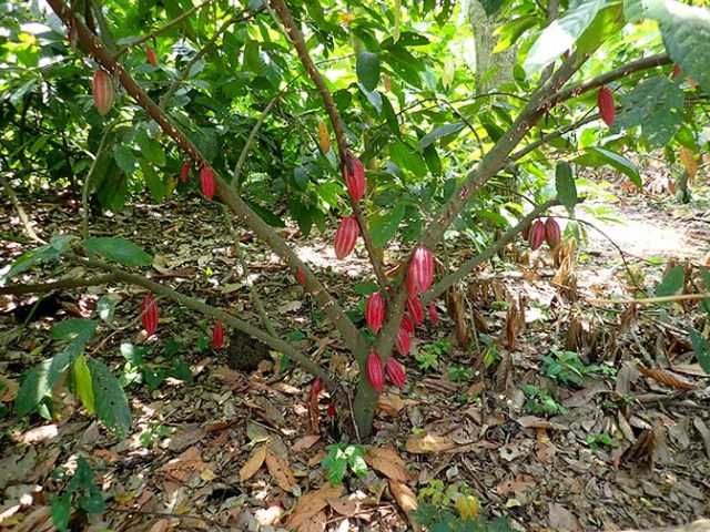
red cacao pods on a tree
Ancestral Cacao Plantation & Chocolate Making Workshop
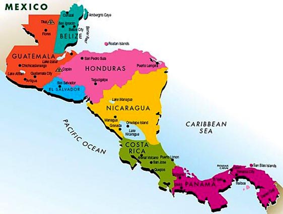
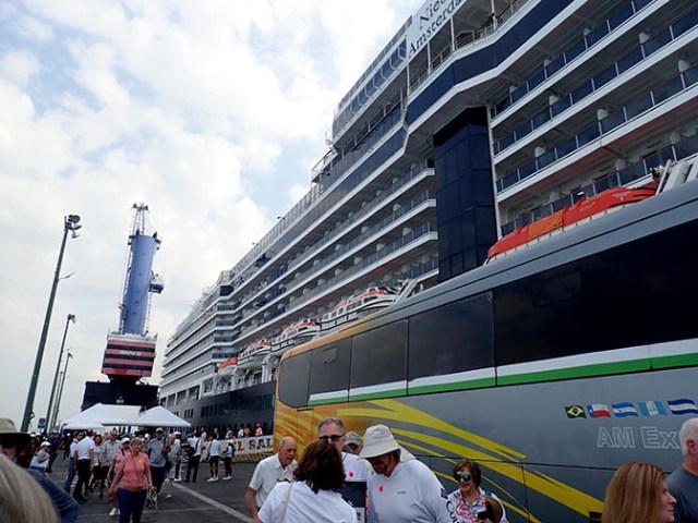
At our port stop in Acajutla, El Salvador on Holland America Nieuw Amsterdam we booked an excursion called Ancestral Cacao Plantation & Chocolate Making Workshop. The excursion information from the cruise line differed a bit from the actual tour.
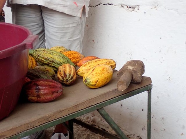
colorful cacao pods
Cruise Ship Description of the Tour
TOP 3 REASONS TO BOOK
A guided tour through a cacao plantation
An extensive chocolate-tasting session
A hands-on chocolate-making workshop
ABOUT THE EXCURSION
Don’t miss this delicious experience that explores the history of cacao in Central America.
Before the Conquistadors arrived, indigenous cacao plantations sprawled far and wide across the Salvadorean territory. As the indigenous population decreased, along with the production of cacao, the Spaniards migrated the cacao plantations closer to the cities of Sonsonate and Izalco. Join a local expert to learn about the history of cacao with a guided tour through a plantation.
Stroll through botanical plantations among a variety of cacao trees, absorbing the techniques of turning raw cacao seeds into the finished product. Enjoy and appreciate an extensive chocolate-tasting session. You will also get acquainted with the process of drying, roasting and grinding the cacao.
There’s nothing more fun than a hands-on chocolate-making workshop, so make the most of a chance to create your very own chocolate bar. The legacy of El Salvador’s Mayan ancestors comes to life as you enjoy the aromas and tactile aspects of producing beautiful melt-in-the-mouth chocolate. It’s about the differences between cacao types, the trees, the process and, finally, all about your hand-crafted, totally unique chocolate bar. Was it delicious?
Notes:
Wear comfortable, closed-toe (mandatory) walking shoes. Shade is limited; to avoid sunburn, wear light, long clothing suitable for use as a cover-up. Bring a hat and sunglasses; wear biodegradable sunscreen. Bring bottled water.
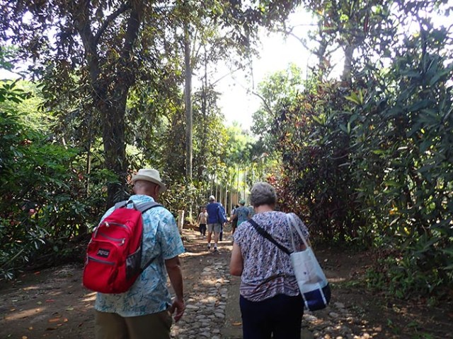
walking from the bus to the plantation house
The Actual Excursion
It seemed that either something was lost in translation or someone in marketing who wrote that blurb really had no clue what this excursion involved. Some of the people at the plantation spoke little English and even the one they called their translator had problems with some words. They were all learning about running tours as well as working on their English as they were new to providing tours at the plantation. They were not new to running a plantation though as it has been in the family who currently owns it for over 100 years and cacao trees have been farmed at that plantation for 3000 years since the time of the Mayans.

plantation house
Our tour started with a bus ride of less than an hour. Upon arrival at the plantation we all got out of the bus and walked up a rocky, uneven road to a building that was the original plantation house, but not where the current owners live. That walkway and pretty much all of the walking areas of this tour are not suitable for wheelchairs, walkers, or anyone who has difficulties walking on uneven ground. That was not made clear in the excursion description and there was one gentleman in a wheelchair. He was at least able to walk on and off the bus and for short distances, but his wife was saying that the excursion should have been listed as not accessible for wheelchairs as they did have difficulty maneuvering it around. They also were not able to walk through the forest of trees, but the excursion description did mention walking through a plantation so there was some warning there.
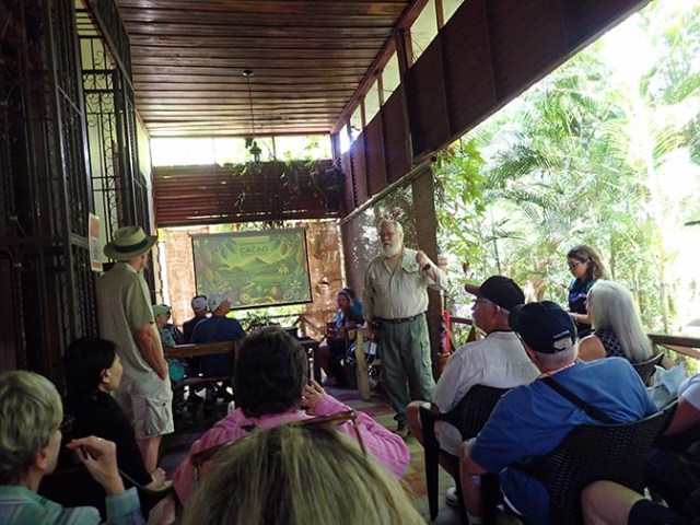
presentation at the beginning of the tour
Everyone sat on a porch area of the old house for a photo presentation on the history of the area and of the plantation. The plantation owner sometimes spoke in English, but most of the presentation was first done in Spanish with the translator then repeating it in English. He mentioned that there had once been a lot more cacao trees growing in that area, but that volcanic eruptions had destroyed a lot of them. He said it was the newest volcano in the area having rapidly developed sometime during the 1700’s. It is called Izalco and it erupted nearly constantly from 1770 until 1958, earning it the nickname Lighthouse of the Pacific. This particular plantation was not affected by the eruptions, but some neighboring ones were destroyed. The volcano is currently in a quiet state not having erupted since 1966, but it is still considered an active volcano and sometimes emits steam and gasses.
The owner said that his son had married an Italian woman and built a chocolate factory in Europe, which is where they send the majority of their cacao beans because they do not have a factory on the plantation. Which left people to wonder about the bit in the excursion blurb about making our own unique chocolate bars. Something I had previously done in Nassau at a place that made chocolate, but imported the raw cacao beans which are not grown in the Bahamas.
green cacao pods
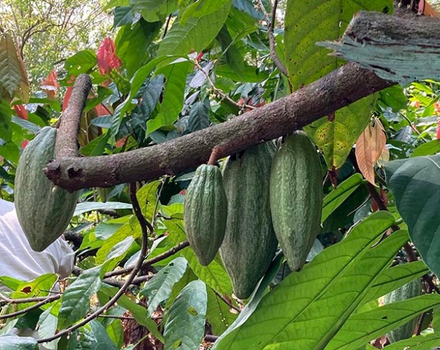
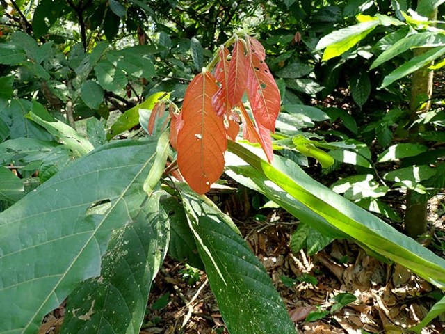
After the presentation we followed the owner out into the plantation where we were shown several varieties of cacao trees. Some had red pods and others green. The flowers are reminiscent of poinsettias because like poinsettia flowers they look pretty much like colored leaves. Mingled with the cacao trees there were some tall shade trees and some of the trees of which they harvest the bark for cinnamon as well as vanilla orchid plants snaking their way around some trees.
cacao flower
Previously that plantation had just grown cacao, but they are diversifying now because with the warming climate they can’t always count on a good harvest so now they have some other products to fall back on. The shade trees are new as well. They were not necessary in the past, but are now since it is otherwise sometimes too warm for the cacao trees. It was quite warm while we were there and it was fairly early spring.
nursery trees
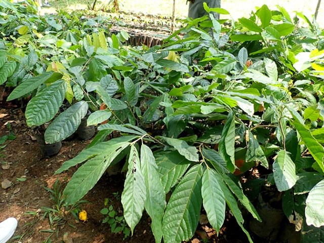
The plantation owner said it takes about a year for cacao trees from their tree nursery to grow large enough to plant out in the plantation, and about 7 years before they can harvest from those trees. Whatever variety of cacao tree they want is grafted onto a sturdier root stock while the plant is still within the nursery stages. They have to replace the trees because they don’t stay productive forever. They did not say exactly how long on this tour. The chocolate factory in Nassau said only a few years, but google says a cacao tree stays productive enough to be commercially viable for about 25 years, though it can live much longer (100-200 years or maybe even more).
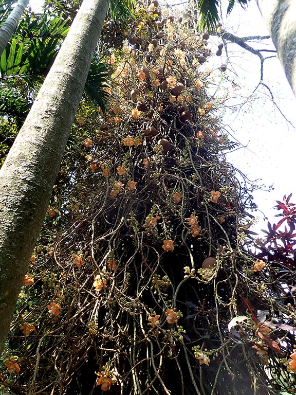
cannonball tree
Other trees on the plantation included some fruit trees and something called a cannonball tree among others. The cannonball tree had lovely orange flowers and gets its name from the fruit it makes which is about the size and shape of a cannonball. It is not something that people eat, but some of the wildlife like it.
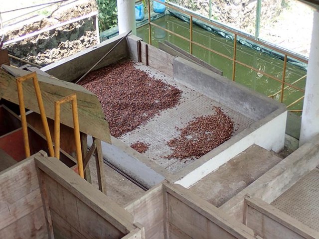
cacao beans drying
A short hike to a different area brought us to a building where they had cacao beans roasting and giant poles of bamboo curing. Later we went to a bamboo forest.
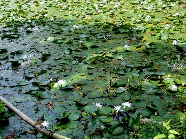
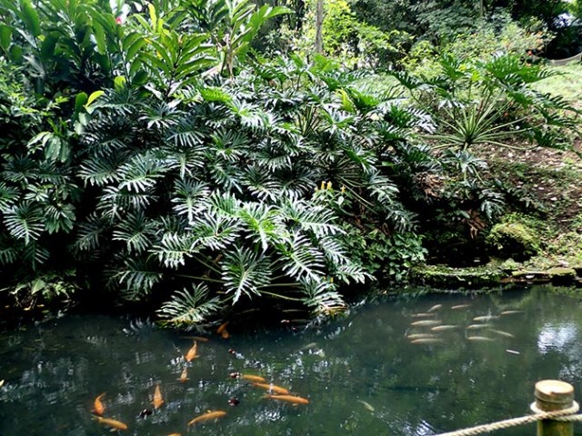
pond covered in lily pads
We passed two lily ponds and a coy pond along the way, which were all part of a natural spring system.
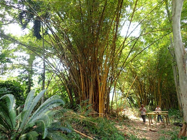
bamboo
The type of bamboo growing there was not the sort that spreads uncontrollably. They said they had started planting the bamboo 25 years ago and it has always stayed within the area where it belongs. When individual plants get big enough they cut them down to use for various construction projects on the plantation. Though bamboo looks like trees it is actually a type of grass.
open cacao pod
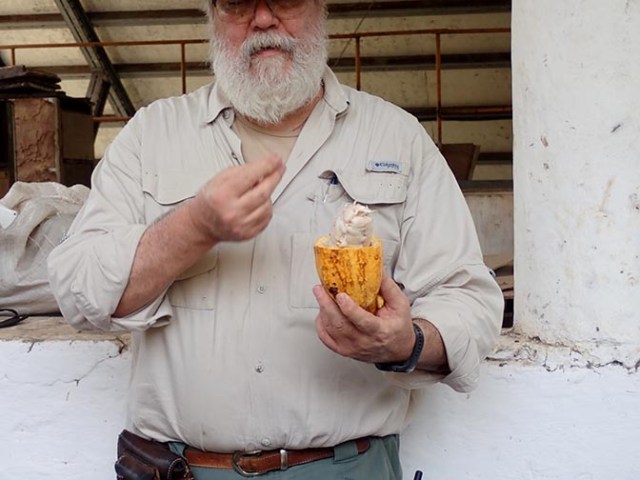
At the drying building they opened a cacao pod and let people who wanted to pull off one of the white sticky beans to lick off the sweet gooey stuff on the outside of it. They also had some whole pods there that people were allowed to try to crack open to put the seeds into a big bowl. They have to be scooped out by hand to get just the seeds and not the membrane from between them that holds them together even after half of the seed pod is removed. The next step for those beans is a trip into the roaster.
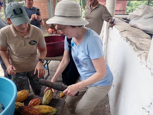
Linda cracks open a cacao pod
Not everyone could see the roaster at once so people took turns walking up the stairs to the area where they could look down to see it. In front of the roasting building in a small spot of shade where some, but not all of the people on the excursion could get out of the hot sun people were allowed to try cracking open a cacao pod and scooping out the beans if they wanted to.
bamboo shed for roasting demonstration
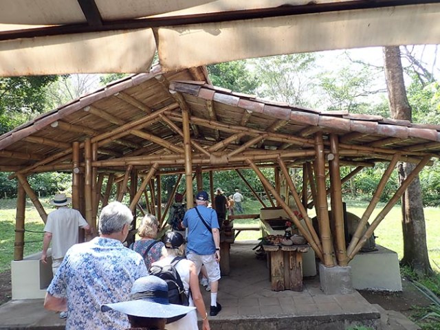
The final stage of the tour went back to a new addition made from bamboo grown on the plantation at the back of the original house. This building was behind the one where we started and was the only place other than the talk at the beginning that the guy in the wheelchair made it to. There was not enough seating built-in for the entire group so some people stayed standing and others sat in the proffered plastic chairs. Our tour was 5 people short of the limit since there were 5 that didn’t show up on time even though the tour did not leave the staging area onboard the ship early.
Since that area was crowded and not everyone could see the beans in the roaster at the same time the tour probably should have been limited to a bit smaller group size rather than the maximum amount that a full-sized tour bus holds. It was a popular tour having sold out the original time as well as a second one that was added later in the day. We were on the first tour, but started out on a wait-list for booking it long before the cruise began. The option to book actually came available while I was on another ship and the online booking would only say it was waitlisted rather than actually letting me book the spot that had come available so it was a good thing that the shore excursion people on the Oosterdam were able to take care of it as the window of opportunity would have expired by the time I got home where I could have called them.
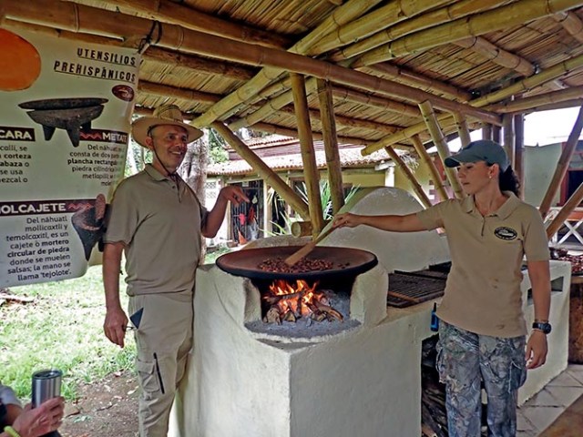
roasting cacao beans
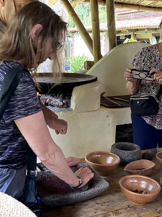
For the demonstration they started with a small amount of raw cacao beans prepared in the traditional manner of their ancestors. First a girl from the plantation roasted them in a big metal pan sitting on a grate over a fire. Most of what she said was in Spanish with the translator then repeating the English version, though she did know some words in English. Everything in that shed was done the ancient Mayan way with the sorts of tools that they used other than they had mentioned them not having metal so they wouldn’t have had that pan. The seeds had to be stirred some so they wouldn’t sit in one place and burn. They were ready when they started making noises like popcorn popping.
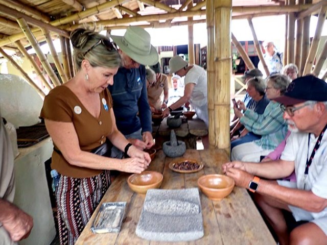
shelling cacao beans
Various people from the tour had turns removing the shells from individual beans. They had bowls to put shells in and most of the beans went into the first grinding bowl, though people were allowed to taste a shelled bean if they wanted to. They were crunchy and had a taste of bitter chocolate that was almost more prevalent as an aftertaste.
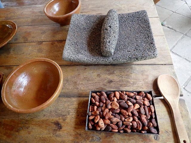
cacao beans and grinding tool
The shelled beans in the stone bowl were then ground to a paste using first a mortar and pestle type grind in that stone bowl, then moved to a little stone table sort of thing with a stone tool something like a rolling pin, but without any handles or moving parts. It’s not easy grinding those beans. It takes a lot of what the old timers would have called elbow grease – in other words a lot of pressure from the person using the grinding tools because the tool doesn’t grind it on its own.
grinding cacao beans
Next the paste went into a clay pot where it was blended with hot water using another ancient style tool. Then it was ready to serve in little clay cups like what the ancient people would have used. They made a point of saying the drink was cacao, not chocolate because the chocolate making process includes adding sugar. They did have some sugar available in case people wanted to sweeten their drink, but I did not see anyone use it.

clay cups
After everyone had their drink it was nearly time to go, but there was a little table of merchandise people could buy set up on a side porch of the old house. Besides some little jars of cacao beans they had jars of vanilla and some snacks made of what appeared to be two rice cakes with chocolate in between, which were pretty good. There might have been some other things too, but there were too many people crowded around the table to see.
Although this excursion was not exactly what the description said it would be, it was still a nice excursion. They just needed to replace the part about extensive chocolate tasting and making a chocolate bar in a chocolate workshop with making a cacao drink the old Mayan way and having a small taste of it.