
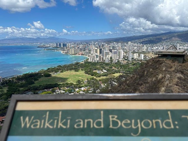
view from the summit of Diamond Head
Before our transpacific cruise on Carnival Luminosa I looked into hiking the crater in Diamond Head for the port stop in Honolulu. Information online said that either the #2 or #13 bus would go from the cruise port to Diamond Head in 20-30 minutes and drop off at the park entrance. Boy were they wrong. Neither of those bus routes went to the cruise port. We had to take a different bus and transfer in Waikiki. The driver of the first bus we were on only said to take 2, which pulled up right on the heels of 13 at the stop where we were waiting after leaving the first bus. It took at least an hour to get from the port to Diamond Head between the two bus rides and time spent waiting at the stop between busses. The park’s bus stop is by the road that goes into the park, not in the parking lot or at the gate where you check in. It’s about a half mile walk uphill and through a tunnel from the bus stop to the toll booth and trailhead area.
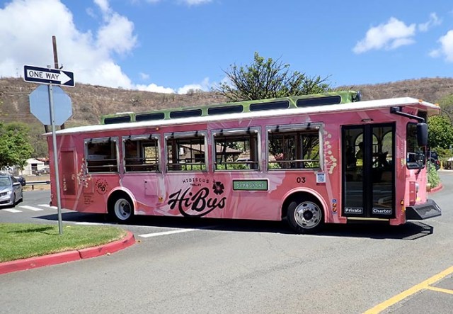
Hibiscus bus comes to the parking lot, but it doesn’t go to the cruise port
Meanwhile while we were walking up the hill one of the Waikiki trolleys went by and took people all the way up to the trailhead parking area. We also saw a pink one called hibiscus bus that went all the way to the trolley stop. The city bus at the time we went cost $3 for each bus or $1.25 for seniors. City busses went by about every 15 minutes or so. We could have booked the trolley ride back down to Waikiki at the park, but the cost wasn’t worth it. It was $12.50 per person when we were there. When we were done with our hike and ready to go back to the ship there were 3 taxis waiting and we were able to get phone service at the trolley shelter so there was also the option to take Lyft or Uber, which will take people all the way back to the ship. If you want to save money you can also walk back down to the bus stop and get back to the ship that way as well. Taxis, Lyft, or Uber are also available from the port to Diamond Head, though the bus is definitely the cheapest option in either direction. An Uber or Lyft all the way back to the port cost about the same as what it would have cost for two people to take the trolley to Waikiki and from there we would have still needed to get back to the port so we found Lyft or Uber to be the better option.
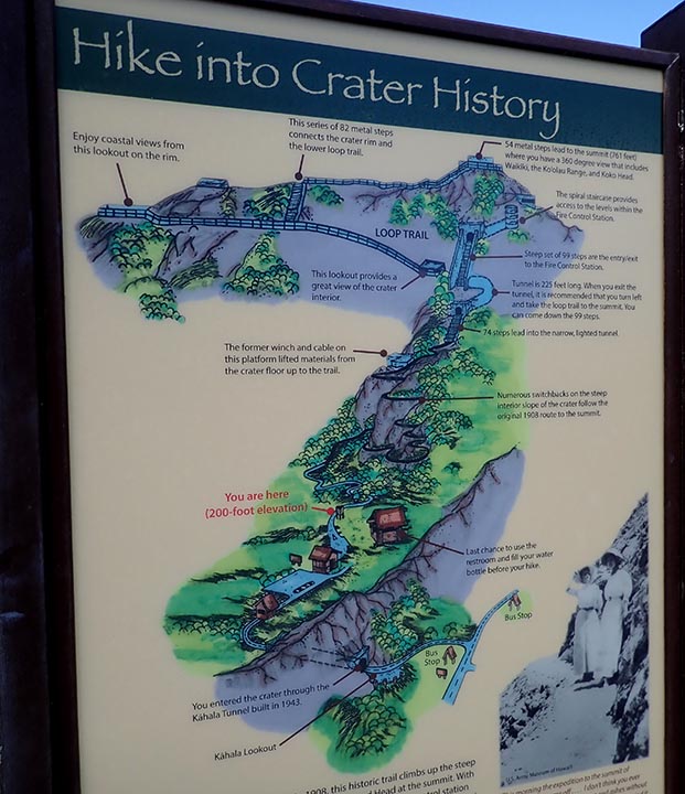
trail map
You can’t just show up at the park and go in. You have to book the entry online in advance. It’s only $5 per person, or at least that was the price when we went there, plus a bit of fees or tax. It’s a good idea to print out the QR code you get with your booking. I had mine printed and got right in while people trying to bring it up on their phones were having a problem with sketchy phone service and not getting it to come up. Or at least screen shot it so you have that photo if you can’t get it to come up otherwise and didn’t print it out because you won’t get in without it. When booking the entry you choose a one- hour time slot in which you are allowed to enter so it is important to know how long it actually takes to get to the park. We thought we would get there right at the beginning of our time slot or maybe slightly before, but between the two busses and the hike up the hill we only had 10 minutes left before it expired by the time we got to the toll booth.
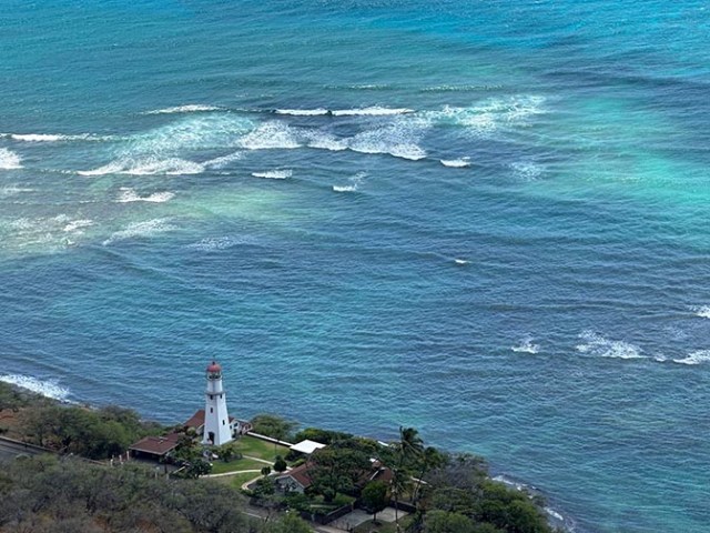
view of a lighthouse from the top of Diamond Head
The trailhead has snacks and drinks available. There was a food truck selling pizza and a lady selling bottles of water from a table near the restrooms. There are no amenities along the trail or at the top, just at the trailhead. All the lists that say you need comfortable walking shoes, water, sunglasses, and a hat are correct. You also need to wear sunscreen. Something I did not see anyone mention anywhere that would also be useful would be some sort of towel to wipe sweat off your face.
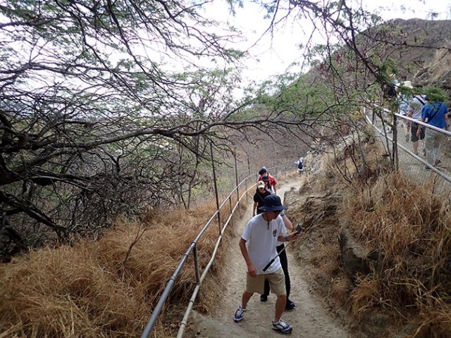
trail
The way up is steep in places, there’s very little shade along the way, and Hawaii tends to be hot. It was mid 80’s F when we went. So the likelihood of your head sweating on the way up is high, especially when wearing a hat which is necessary to keep from sunburning. The trail is 1.3 kilometers (8/10 of a mile) from bottom to top. It starts out relatively smooth and paved. You don’t get too far up before the pavement ends and it becomes very rough and uneven ground, which lasts the rest of the way up except where there are stairways. There are steep parts alternating with flatter parts with an elevation gain of 560 feet in less than a mile.
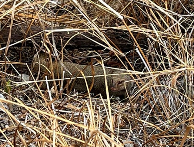
mongoose
As the trail started uphill just past the paved area we saw a mongoose in the grass alongside the trail. These were introduced into Hawaii in the 1870’s to control rats, but since rats are nocturnal and mongooses are not that did not work out. It was very cute, but they are a non-native invasive species and wreak havoc on ground nesting birds and other native wildlife.
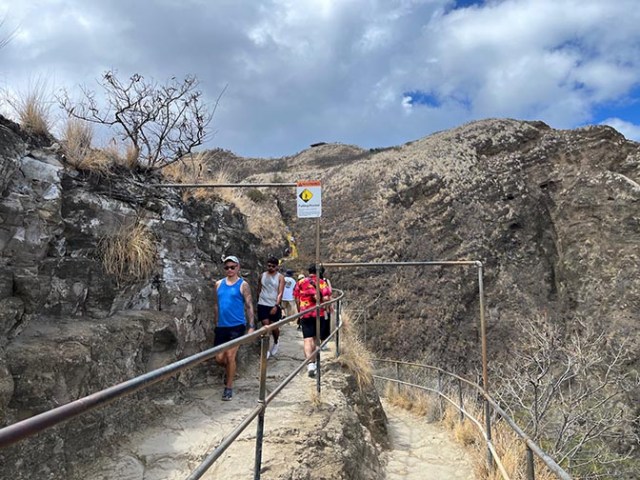
switchback on the trail
The trail up the crater goes in switchbacks back and forth as it works its way up to the top. Going up is somewhat of a workout, but we saw both very young children and people older than us along the way and they made it so it’s doable for people who don’t have mobility issues or other conditions that prevent them from taking a strenuous hike. Coming back down is easy and a whole lot quicker than going up. There are several stairways along the route, some of them quite steep.
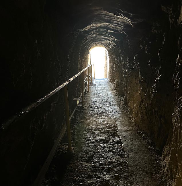
the tunnel
Once you get near the top there are a couple of lookout points for photos. A steep stairway leads to a tunnel, which some people don’t like. I’m not sure why they don’t like the tunnel. I thought it brought some very welcome shade since most of the trail is out in the sun. On the other side of the tunnel a sign says loop trail with an extremely steep 99 stairs to the right or a longer trail to the top on the left. It advises going left, though some people took the stairs up and said walking up that stairway was not nearly as bad as it looked.
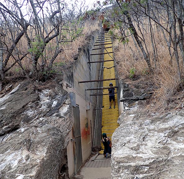
99 stairs
The trail has a viewpoint and rest stop on the left route just after the tunnel. There’s another viewpoint a little way farther up, and a dead-end bit of trail to another viewpoint beyond that. From that route you still have to take stairs to get to the top. Maybe not as many, but they’re still pretty steep. There’s an old bunker at the top with a trail going round one side and a way up to the very top.
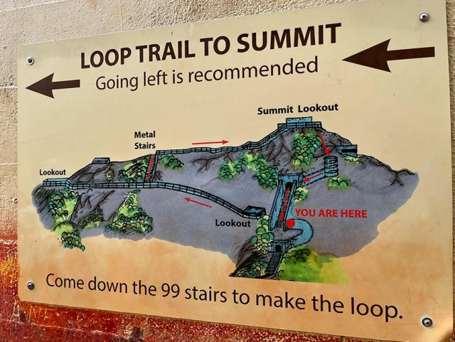
loop trail sign
If you want to take the round trip loop and came from the left side route then go up to the very top before going around the side to see the bunker. There’s several levels at the top, all with good views. There was a line to get to the highest platform where everyone wants to take photos.
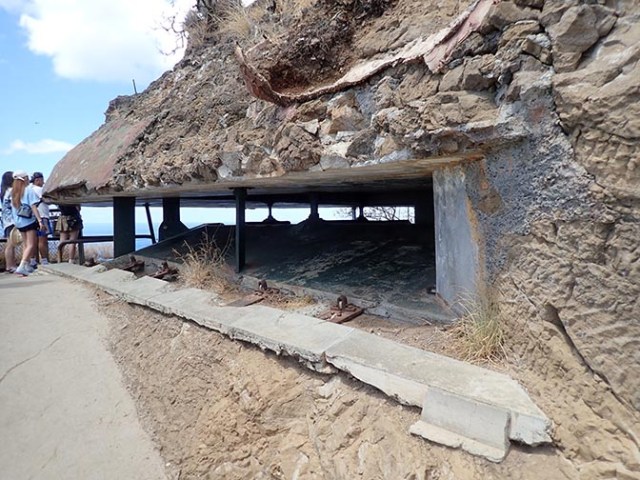
bunker
The reason to go to the bunker after seeing the very top is that if you take the loop rather than going back the way you came, that is where to find the way down. Duck down to go inside the bunker and go to the back where there’s a spiral stairway. That spiral stairway leads down to where the very steep 99 stairs come up. Of course if you chose the stairway route up then you would come up the spiral stairs into the bunker before arriving at the top.
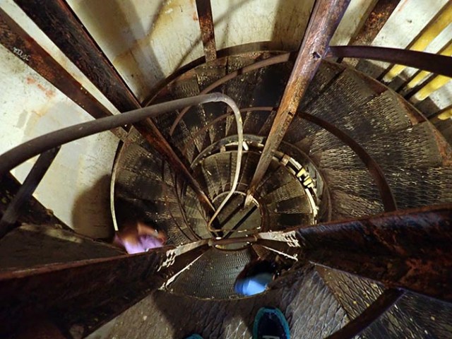
circular stairway in the bunker
There are some pretty good views from various points along the trail, some just from the trail itself rather than designated viewpoints, but nice as they are they don’t come close to what you can see after making it all the way up to the bunker.
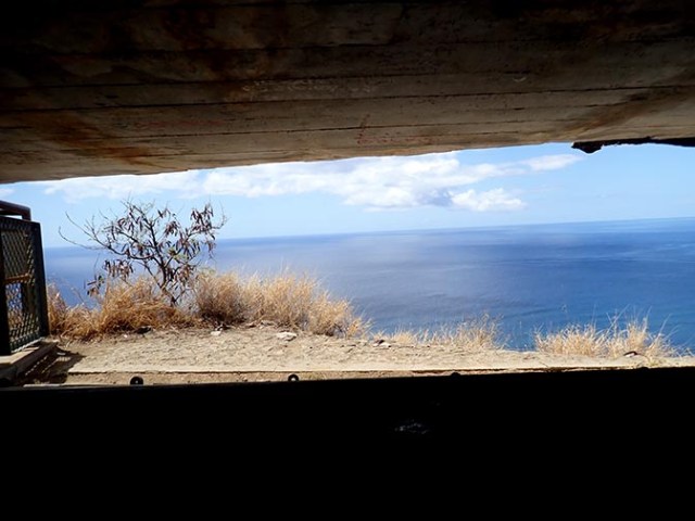
view from inside the bunker
The views are incredible from the top. You can see out over the water, another leftover fort type structure, a lighthouse, Waikiki, and of course a lot of water.
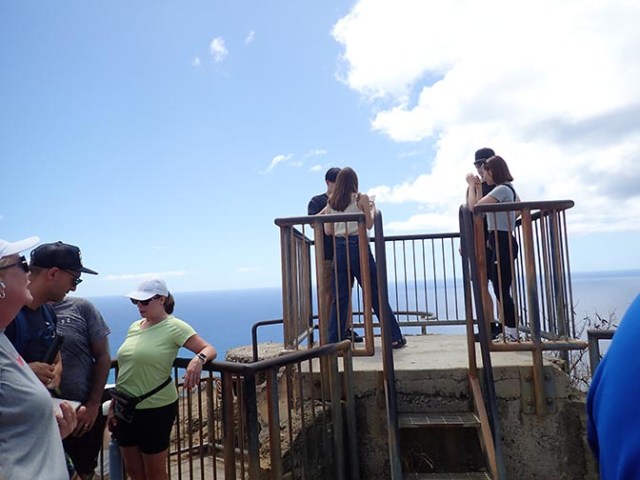
platform at the top of Diamond Head where everyone waits in line for a photo
Going back down is like a refreshing break after the uphill climb to the top. There were a lot of little plants alongside the beginnings of the trail. A sign you see on the way back down says if you have water leftover the plants would love it if you poured some on them. They all had little flags next to them, which after reading the sign seeing all those little flags waving in a bit of a breeze seemed like each little plant crying out me, me, me in hopes of a bit of water from passing tourists.
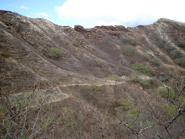
view of the trail from the trail
Diamond Head State Monument is a major landmark in Hawaii. Including both the inside and outside of the crater it covers more than 475 acres. A single underwater explosion around 300,000 years ago created the crater with the ash and fine particles it sent into the air falling back down and cementing together into rock called tuff. Most of the park’s birds and vegetation was introduced in the late 1800’s to early 1900’s.
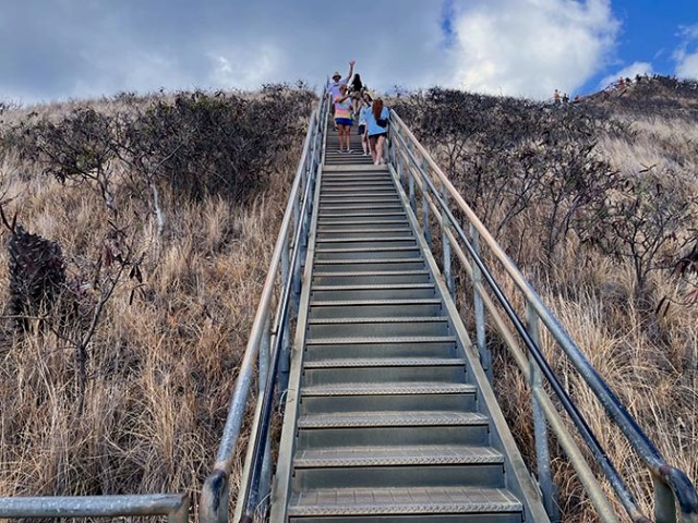
metal stairway near the top of the summit
The trail to the summit was built in 1908 as part of Oahu’s defense system. Reminders of its military history still exist with the old bunker and other structures at the top. The 225-foot lighted tunnel at the top of the steep stairway was built as access to the Fire Control Station completed in 1911 to direct artillery fire from batteries in Waikiki and Fort Ruger outside of the crater. The bunker at the crater was fortified with guns in the 1940’s during WW2.
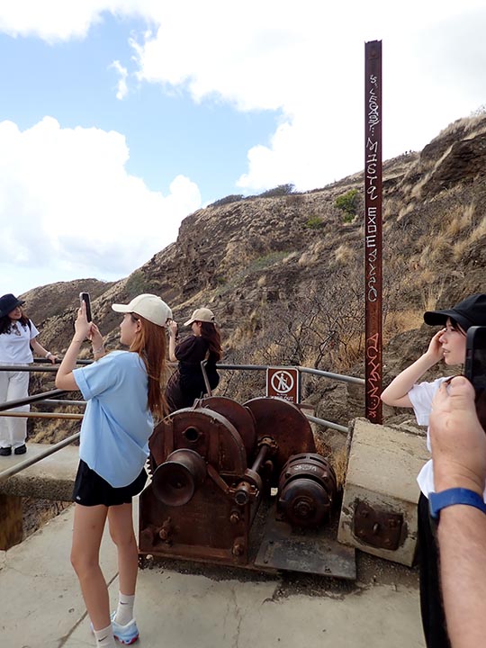
viewpoint with a winch
One of the lookout points near the top has part of a winch structure left that was used to haul military supplies up to the summit when the bunker up there was in use. The lighthouse on the shore visible from the summit was built in 1917.
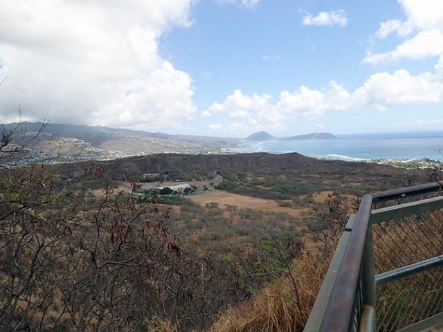
view of the trailhead from the trail
Park facilities on the crater floor are fully accessible. Only the first paved third of a kilometer of the hiking trail is accessible. Beyond that is where the pavement ends and the natural tuff surface of the trail begins. As previously mentioned, the unpaved trail surface is quite uneven and full of ruts.
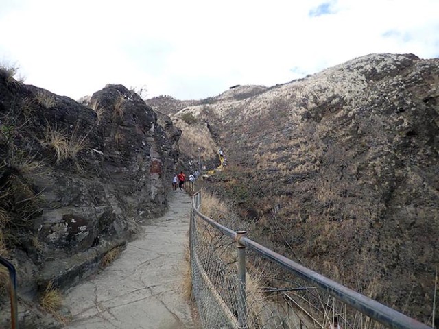
trail
The park’s webpage advises allowing 1.5 to 2 hours for your hike. They also have the advice mentioned by other sites to wear good walking shoes, bring water, and wear a hat and sunscreen. Like the others they also neglect to mention that a sweat rag could be beneficial.
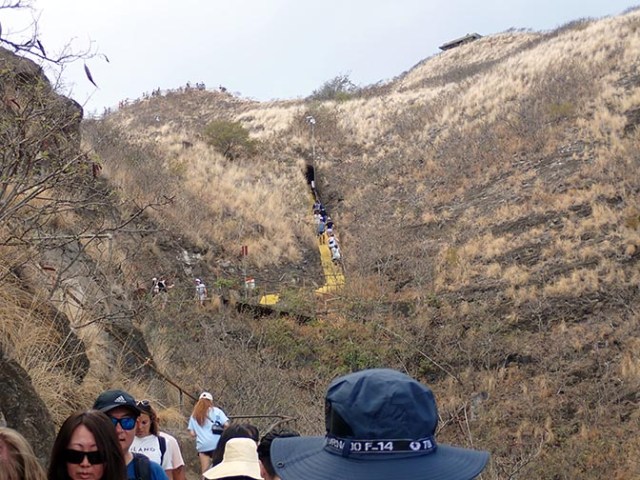
first major stairway on the way up
On the way up we saw a series of signs indicating places where there was something to hear on an audio tour. People can purchase the self-guided audio tour at the gift ship before they start their hike. We did not buy it, but the park’s website says it focuses on the history, culture, geography, plant and animal life, and scenery at Diamond Head.
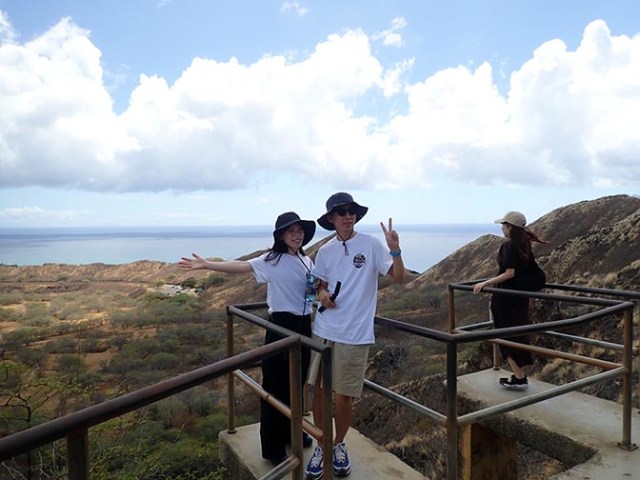
random people posing at the first official viewpoint on the way up
Visitors to the park exceed 3000 people daily, which explains the need for timed entries and limiting visitors to those who purchased their ticket in advance. There was a steady stream of people going in both directions, but not so many as to have the trail solidly filled with people. There were gaps between groups of hikers and some empty trail space. We were never alone at a viewpoint, but the only one with a long wait for photos was at the very top. There was a shorter wait at the one that still has parts of the old winch system.
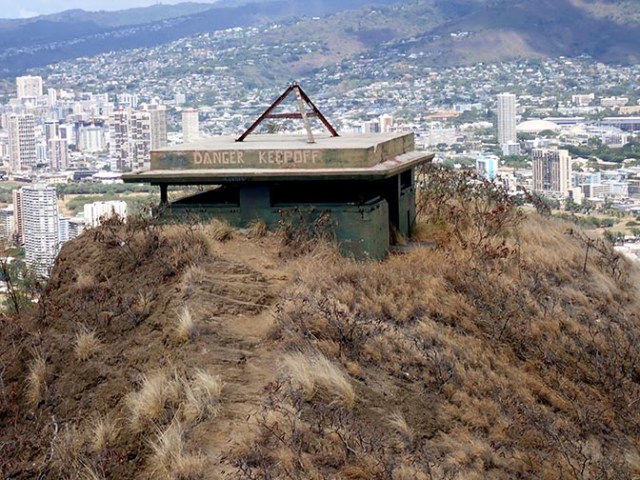
other military structure seen from the summit
The name Diamond Head came from 19th century sailors mistaking calcite crystals for diamonds. Its Hawaiian name, Lēʻahi (or Lae-ahi), means “brow of a tuna,” referring to the shape. It was declared a national natural landmark in 1986 and is currently preserved as a Hawaiian state monument.


This is not just a story about hiking Diamond Head. It is about how unexpected struggles shape meaningful experiences. The wrong buses, steep paths, heat, and exhaustion become part of the journey rather than obstacles. The climb represents life itself: difficult routes often lead to the most rewarding views and discoveries.
That’s some pretty deep thoughts.