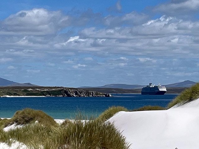
view of the Oosterdam from Yorke Bay
Stanley, Falkland Islands
The Falkland Islands are self-governed, however they are a British overseas territory so the language is English. Money is the Falkland pound, which is of the same value as British pounds. US dollars are accepted, as are cards. At the time of our visit it took $1.25 in USD to equal one FKP but with the decline of the US dollar vs foreign currencies it now takes $1.32 USD to equal one FKP. Do not try to use Argentinian money in the Falklands. There are still hard feelings between the Falklands and Argentina due to the Falklands war in 1982. Neither country wants to see anything from the other. We were advised not to wear anything light blue or white while visiting the Falklands since those are the colors of the Argentinian flag.
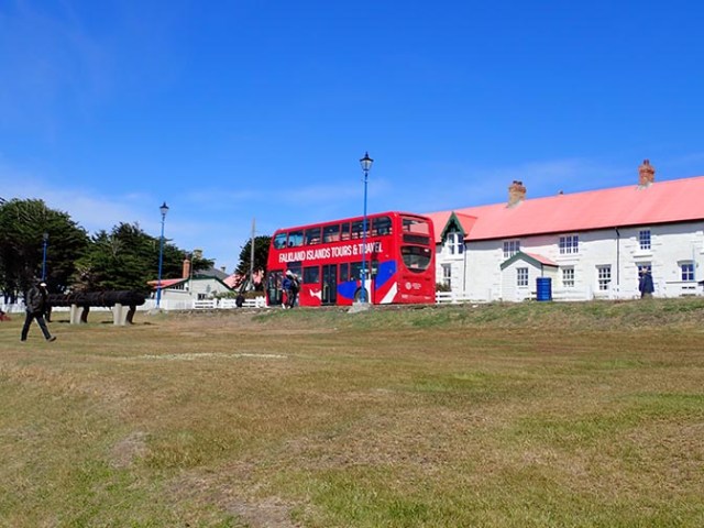
hop on hop off bus
The islanders refer to their country as the Falkland Islands, as do English speaking countries. Some Spanish speaking countries call them Islas Malvinas. Stanley is the capital and only city in the Falklands. Phone and Wi-Fi service are specific to locals only so cruise ship passengers can’t get Wi-Fi on their devices there.
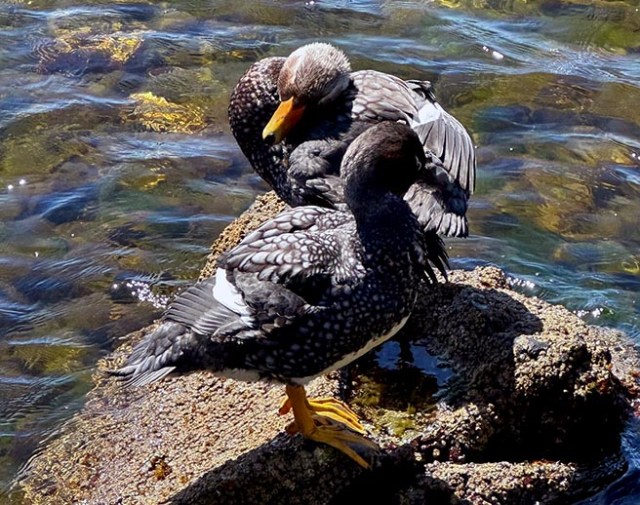
ducks in the water next to a waterfront trail
Average monthly temperatures range from around 9 °C (48 °F) in January and February to around 2 °C (36 °F) in June and July, corresponding with summer and winter. Since the Falklands are in the southern hemisphere the seasons are reversed from what people living in the northern hemisphere are accustomed to. The maximum temperature reached is around 24 °C (75 °F) in January, and the minimum is −5 °C (23 °F) in July. Annual rainfall is about 25 inches (630mm). There is some fleeting snowfall in the winter.
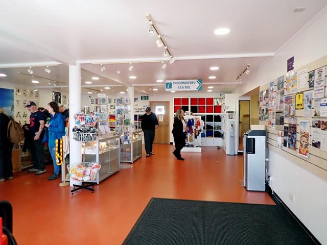
gift shop in the visitor center at the port
The Falkland Islands carry no national debt. Instead they wait until they can afford any new infrastructure before building anything, which mean it can take awhile to get things done.
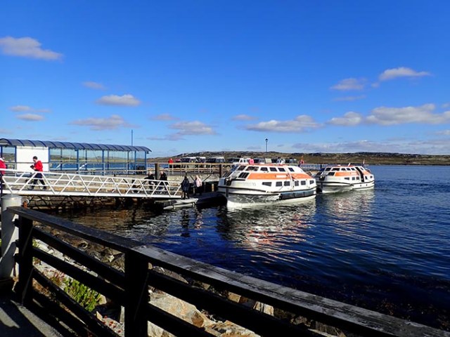
tenders at the dock
Stanley Cruise Port
Port Stanly is a tender port. Ships anchor out in the bay with a view of the island, but not of the tender pier. Tenders arrive at a floating dock with a ramp up to the pier. There is a visitor’s center on shore by the dock. Inside there is a gift shop and information booth. Outside it had an old fashioned red British telephone booth with a working phone. There were more of them around the town. The visitor’s center also had restrooms.
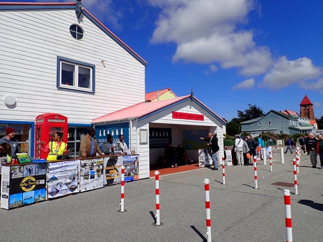
visitor’s center at the port
Out in front of the visitor’s center there were a line of little booths with people offering last minute tours. Some of these tours went to Yorke Bay Beach. Penguins live there so people who want to see penguins but were unable to book a penguin tour through the ship may be able to get one on shore. We visited Stanley from Holland America Oosterdam, which spent enough time in port that we were able to take a ship’s tour, a last-minute tour from the port, and still have time to walk along the waterfront and visit some of the town’s attractions.
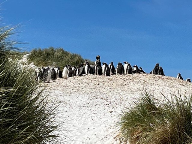
gentoo penguins at Yorke Bay
The penguins at Yorke Bay beach live in sand dunes. It’s a long walk through the dunes to see them. Especially from the hop on hop off bus where people have to walk up the long gravel road to the dunes before walking through the dunes. Taxi tours will take people much closer to a parking lot at the edge of the dunes, but you still have to walk on trails through the sand to see any penguins. You will get closer to the penguins with less walking on a cruise ship tour. At least on one the one that goes to Bluff Cove. I can’t say for any others for sure.
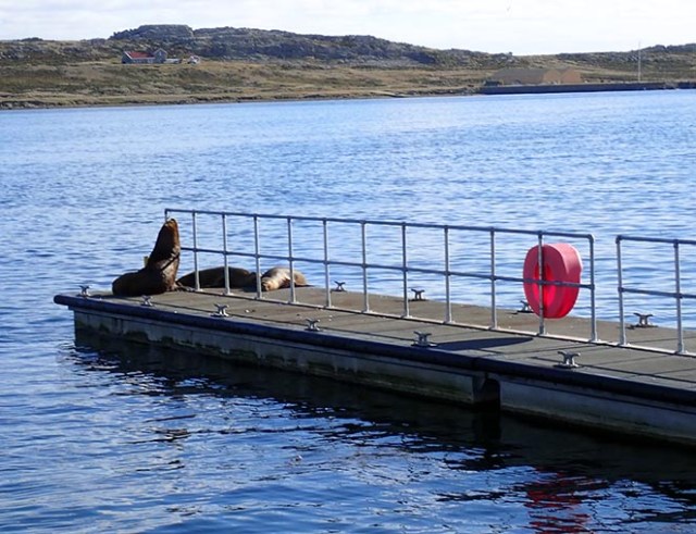
sea lions on a dock
The dock next to where the tenders came in had sea lions sleeping on it when we first got there, but they were gone when we went back to the ship.
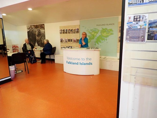
information booth in the visitor center at the port
Things to do in Stanley
There are things to see and do within walking distance of the tender pier. There are a couple of pubs just uphill from the dock, and a restaurant within walking distance to the right. There are several gift shops and a grocery store within walking distance. If you go into the grocery store and see a long line at the cash register at the front of the store, go to the back. There are a couple more registers and some self-pay stations at the back that had no line at all while we were there – and there were about 30 people in line at the front.
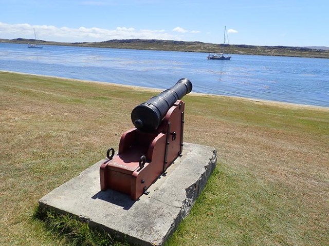
Cannon at Victory Green
We were given a map of local attractions on the Holland America Oosterdam for our port stop there. Turning right from walking the dock facing shore then walking along the water from the pier takes you to most of them. Only the graveyard was to the left. Of the things listed on the map, all were right on the road closest to the waterfront except the government house, which was up a hill.
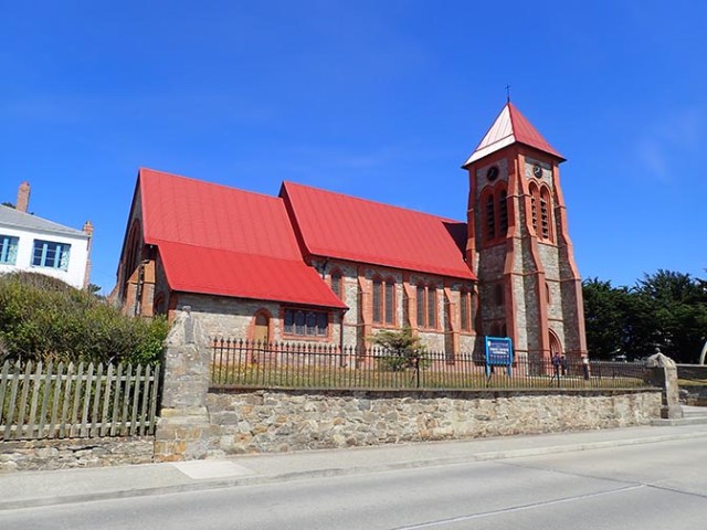
Christ Church Cathedral
The first thing on the map is Christ Church, which you can see from the port. It is the southernmost Anglican Cathedral. According to the info provided by the ship it is just a tenth of a mile from the port and is known for its stained glass, pipe organ, historic memorabilia and iconic whalebone arch.
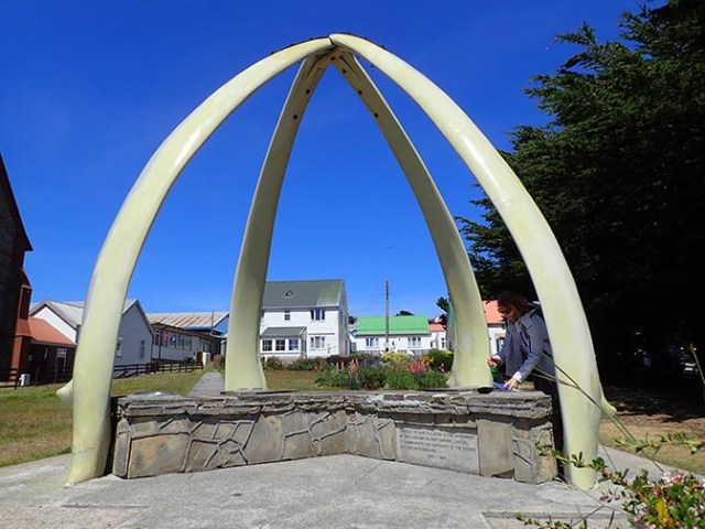
whalebone arch
The whalebone arch sits in the churchyard and is made from whale jawbones. These jawbones are gigantic as the arch towers over any person standing under it.
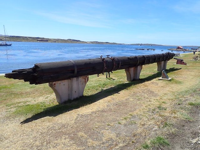
mizzen mast at Victory Green
The next place on the map is quite close at about a fifth of a mile from the port. It’s called Victory Green and is a World War 2 memorial made up of things on the grass next to the water. It has some cannons pointed toward the bay. If there are any ships anchored out there you might be able to take a photo looking like a cannon is aiming at them. The featured item in that park is the Mizzen Mast of the 1843 ship SS Great Britain.
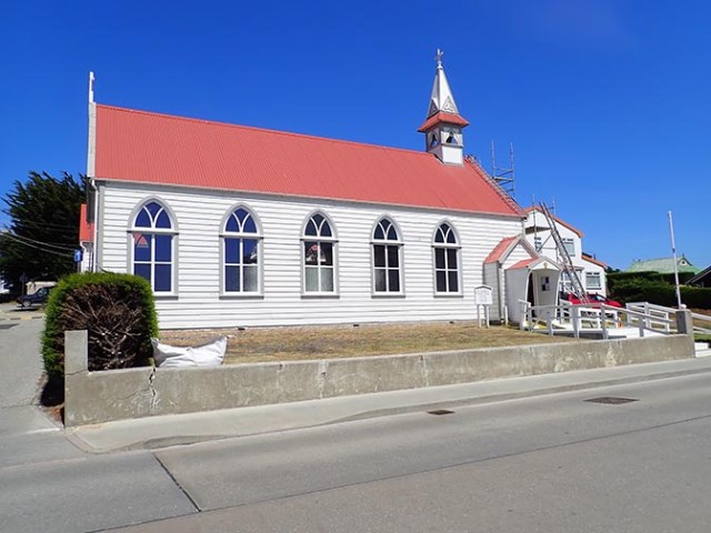
Saint Mary’s Church
At just under a third of a mile, St. Mary’s Church is not much farther. This one is a catholic church. It is smaller than the other church and was built in 1899.
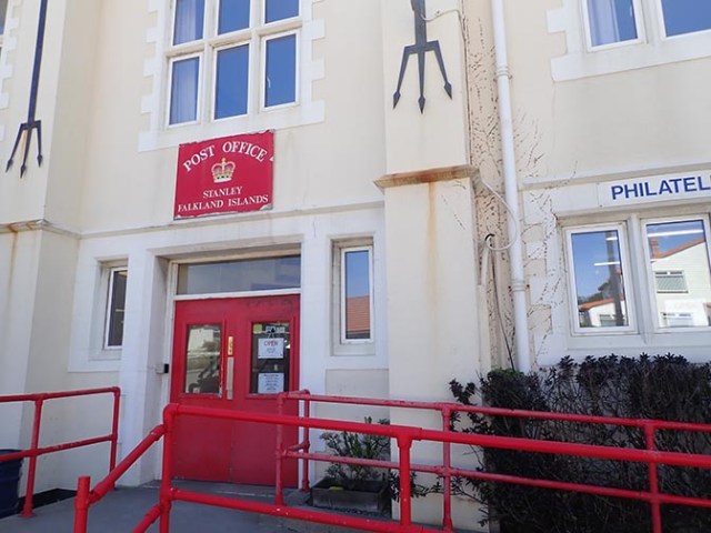
Stanley Post Office
The Philatelic Bureau is across the street from the church, in the same building as the post office. The blurb on the ship’s map says there is a unique collection of rare stamps from the Falkland Islands, Antarctica, and South Georgia there.
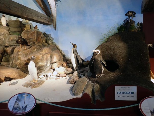
wildlife exhibit at the museum
Next comes the Falklands Island Museum at about 4/10ths of a mile from the dock. It’s behind the building that is right next to the sidewalk. The first building down from the sidewalk is restrooms with a museum sign. The museum is just past that heading toward the water. There are a few large exhibits outside – an anchor, a propeller, and a giant harpoon. A row of shops and a café sit along the water’s edge. It is free to go inside the museum.
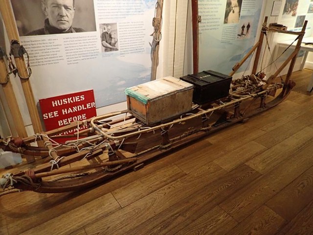
exhibit in the Antarctic room
The museum has exhibits of historic items of daily use as well as maritime exhibits, natural history displays, a display about animals native to the area, and an Antarctic room with a life-size model of a historic cabin. As with attractions everywhere, this museum exits through a gift shop. A pretty small one, but still a gift shop.
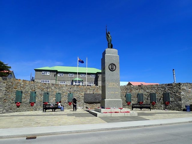
Stanley war memorial
The map says the government house is a historic residence for governors since 1845 with lush gardens, architectural revisions, and a significant role during the 1982 occupation. We didn’t walk up the hill to see it. The last thing on the map from the cruise ship was the Falklands War Memorial built through public effort commemorating the British soldiers and Falkland citizens who died in the 1982 war. It was fairly close to where you would turn to go up to the government house.
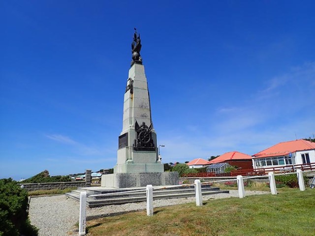
monument
Beyond that there’s a World War 1 monument, a towering structure with different figures on each side of the tower as well as on top.
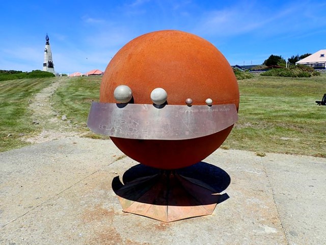
solar system sculpture
Walking a little farther brings you to a solar system sculpture and a view of the remains of a shipwreck out in the water.
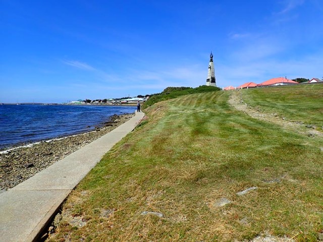
waterfront walkway
The solar system sculpture sits next to a pathway running along the water’s edge while the rest of the things were next to the road closest to the water other than the world war 1 memorial which was kind of in between. The pathway goes on farther for anyone looking for a longer walk.
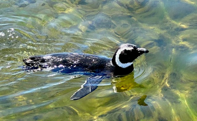
Magellanic penguin
The water next to the pathway was very shallow and clear when we were there. We saw one lone Magellanic penguin in the water right next to the path. Also some ducks that dived under the water and were totally visible while swimming there. We were happy to see the penguin as we had not seen one of that type yet. It was the only Magellanic penguin we saw on the whole trip. We saw lots of gentoo and Adélie penguins in Antartica and king and gentoo at Bluff Cove and Yorke Beach, but just the one Magellanic penguin.


