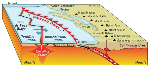
Washington state’s San Juan Islands consist of the peaks of an ancient mountain range on the Juan de Fuca tectonic plate. As this plate subducts under the North American Plate in the Cascadia Subduction Zone which runs from Vancouver Island in Canada to Northern California, it is one cause of earthquakes in the area. Subduction formed the volcanoes of the Cascade Mountains, part of the pacific ring of fire. This inland mountain range includes Mt. St. Helens, famous for its major eruption in 1980. The Olympic Mountains which are closer to the sea do not contain any volcanos. It is typical for ring of fire areas to have non-volcanic mountains closer to the sea with the volcanic range a bit farther inland. The San Juan Islands are not volcanic either.
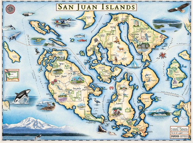
Than San Juan Islands are comprised of over 170 individual islands ranging in size from small rock piles to large forested islands. Early inhabitants of the San Juan’s were native Americans, mostly of the Lummi nation. Although early explorers noted the islands, European settlements didn’t infringe until the 1850’s. After 1846 the Oregon Treaty drew the boundary between the USA and Canada at the 49th parallel except for Vancouver Island which Canada claimed in its entirety. As this large island juts into what is otherwise the USA it caused some confusion as to where the boundary crossed by the neighboring San Juan Islands. Americans interpreted “middle of the channel” at the San Juan Islands as Haro Strait to the west of the islands as the border, being the deepest and widest channel. The English on the other hand claimed Rosario Strait to the east of the islands as the border, putting the islands in their territory.
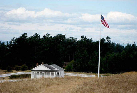
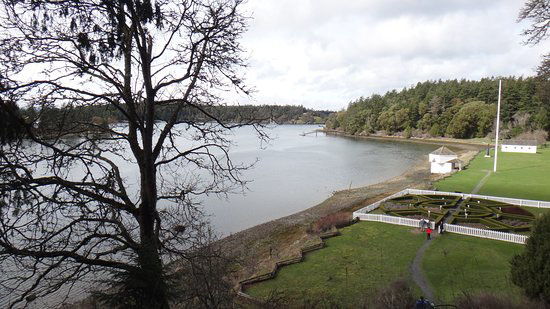
American Camp and English Camp on San Juan Island are both historical parks now. The two together make up San Juan Island National Historical Park. The confusion over ownership of the islands resulted in both English and Americans settling there and each country had an army camp on the island. Tensions escalated when an Englishman’s pig raided an American’s potato patch and the American farmer shot the pig for its nighttime marauding. When both farmers appealed to their nation’s military for settlement war nearly broke out. British warships and troops from both sides came to the islands in a major show of military force. These actions became known as the Pig War, with the only casualty being the pig. The boundary dispute was finally settled in 1872 when German arbitration ruled in favor of the USA.
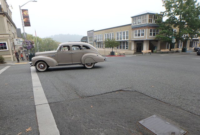
Early settlers to the islands depended on farming, fishing, logging, trapping, and sheepherding. Tourism is a major part of the economy now. The ability to work from home on computers opened up the islands an attractive place to live for people who don’t have to commute to their jobs. They’ve joined the retirees, artists, and writers who have made up a portion of the population for years as people who don’t have to tie their job to where they live. The more populated islands also have some traditional jobs as they do have towns and small cities with stores and other places to work.
Average yearly rainfall in the islands is 29 inches, somewhat less than Seattle’s 37+. The pacific northwest is full of micro-climates with some coastal and mountain regions receiving more than 100 inches of rain annually (some significantly more) while rainshadow areas have less than 20. On the mostly drier east side of Washington State (east of the Cascade Mountains) there are places with less than 10 inches of annual rainfall. Islands in the San Juan’s tend to have their own tiny micro-climates with one side of the island generally wetter with a thick layer of underbrush in the forests and the other side drier with less vegetation between the trees.
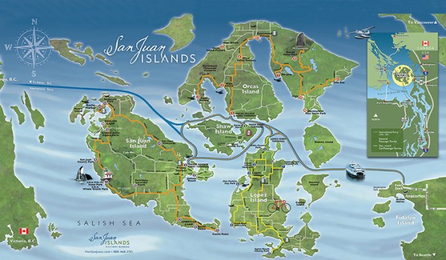
Washington State Ferries provide service to the San Juan Islands from Anacortes. The wait there can be long so reservations are advised. Ferry service goes to San Juan Island and Orcas Island, the two main islands with tourist amenities, Lopez Island which has a village and some vacation rentals and campgrounds, and Shaw Island which has one small grocery store and a few primitive campsites at a county park. The ferry route sometimes extends to Canada on select sailings, at least it does when the border is open anyway. There are smaller inter-island ferries that just go between the islands and not to the mainland. Getting to the islands without ferry service can be done by small airplane, island charter services, or private boat depending on the island. Some small islands are accessible only by human powered craft. Many small islands are designated wilderness areas and/or part of the San Juan Islands National Wildlife Refuge and not accessible to people at all, though a few of those islands have small park areas where people can go.
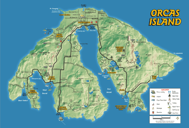
Orcas is the largest of the islands at 57 square miles. Much of the island is hilly and forested. Mount Constitution is the highest mountain in the islands. Its 2,398 foot peak is the highest point in all of the San Juan Islands. Parks on Orcas Island include the over 5000 acre Moran State Park, which is where Mt. Constitution is located. Places to stay include resorts, vacation rentals, and camping. The island has a towns, stores, and restaurants.
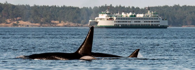
San Juan Island is home to the town of Friday Harbor, which is the county seat for San Juan County. The shoreline along Friday Harbor sports huge homes with private docks. There’s a large marina next to the ferry dock and shops and restaurants in town. The island has lots of farmland as well as other parks in addition to American and English camps. There are lots of places to stay including the historic Hotel de Haro at Roche Harbor Resort. People sometimes spot whales from Lime Kiln State Park.
As a kid I spent time every summer on Obstruction Island, a small private island between Orcas and Blakely where my parents used to have property. When we first went there the island had just one dock and no other amenities other than a dirt road circling the island so people could get from the dock to their lots. Later they added another dock closer to our property, though we just had a small boat and came in at high tide landing on our own bit of beach. At first we had to go to the marina at Blakely to get water if we ran out of what we brought, but at some point a community well was built that we could hike to and get water from an old fashioned hand pump. Eventually they added electricity and piped the water out to individual lots, after which some people built cabins, but we only ever camped. Now the island has a few permanent residents so it’s nothing like the island of my youth where we could go all over the island and never see any sign of other humans. My parents sold their property so we can’t go there anymore anyway.
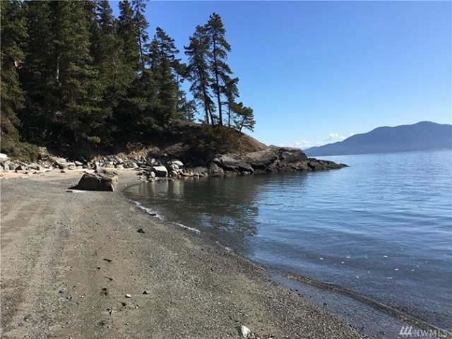
The islands are a great place to get away and relax. There’s no big cities and even the bigger islands have plenty of places to get out into nature. It’s always a great place to visit, and in these times of social distancing and local vacations a great option for people living on the mainland. For those arriving by private boat there are many marine parks. Some entire small islands are state parks, like Sucia which we visited when we took a cruise with Uncruise Adventures, and James. Many of these parks have mooring buoys or docks.
Copyright My Cruise Stories 2020

Enjoyed this Uncruise in 2015 – good weather, great fellow passengers, great beer, good kayaking!!
We had a great time on the Uncruise that year too – although I did not do any kayak paddling that trip as I was recovering from a break inside my elbow joint and under strict orders from both my doctor and my physical therapist NOT to paddle a kayak.