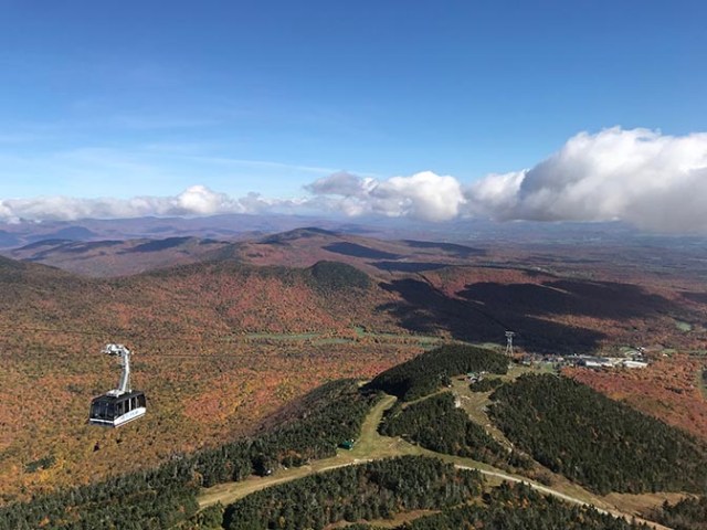
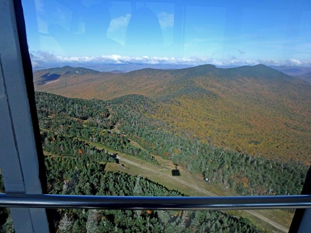
tram view from the top of the peak
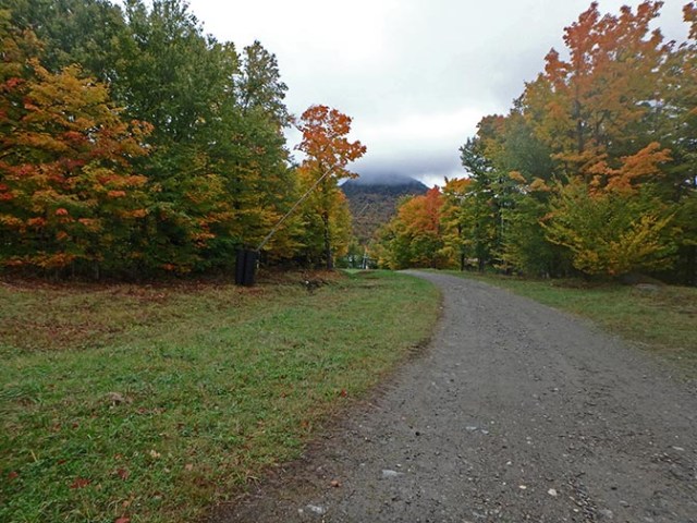
There is quite a network of trails going up the side of Jay Peak between Jay Peak Resort in Vermont and the top of the mountain. When the tram is running it goes all the way up to the top. Some of the trails also go to the top so the upper trails don’t necessarily have to be reached on foot when the tram is running. There are ski lifts all over the mountain too, but none of them go all the way up like the tram does. None of them were open in the off-season when we were there either. Though some of them are quite steep, there are trails under the lifts so you can hike to the tops of many of the lifts or go up one trail and then find lots of others while you are already up on the mountain.
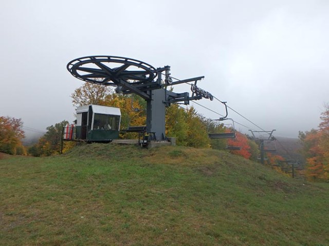
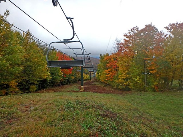
top of a ski lift
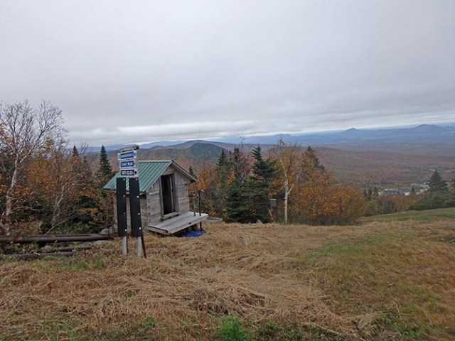
Jay Peak is mainly a ski resort, but when visiting during other seasons the trails are available for hiking, and some for biking as well. They have trail maps in the lobby showing the hiking trails. The trails start on the peak side of the lodge near the tram, but there isn’t any signage indicating what are the official hiking trails there and what isn’t. Some Nordic ski trails start in the same general area. Their entrance is far better marked, though up on the hill it’s just colored numbers for them the same as for the hiking trails. The ski runs have name signs all over the hillside. There are a lot of different ski runs on the hill. Some ski runs go through the forest and are marked as ungroomed glade trails with a warning not to ski them alone.
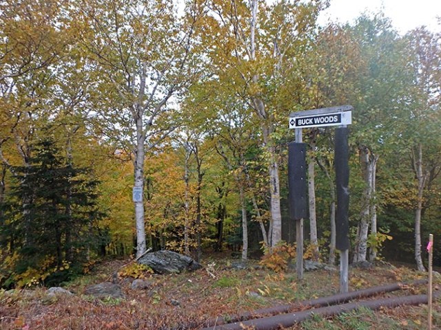
entrance to a glade ski trail
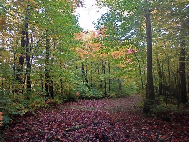
glade ski trail in the fall with leaves instead of snow
If you hike up the mountain you may come across trail intersections with the numbers shown on the hiking trail map. These are often accompanied by signs for other trails saying which trails go which direction. This would be more helpful if the trails on those signs were indicated on the hiking map, but they are not because they are ski runs so the names don’t help any for figuring out where you are on the hiking trail, or in some places whether you are actually even still on a hiking trail at all or have ended up on one of the Nordic trails or a ski run.
Trail or ski run?
This of course means you have a lot more ways to get back down the mountain than indicated on the hiking map, but it also means you may not actually be on the trail you think you are. The ski runs generally go down to the lodge, often with a view of it from higher up, so if you get lost or just want to get back quicker that’s a good way to go. They’re not hard to find since there are ski runs pretty much everywhere. Unlike the hiking trails which are far more limited, poorly marked, and much harder to find.
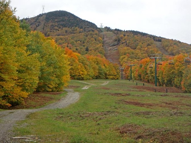
ski runs without snow make steep, but hikeable trails
As previously mentioned, the tram goes all the way to the top of the mountain, but the numerous chair lifts only go partway. It’s not too far to hike to the top of some of those lifts if you don’t mind a sometimes steep uphill hike. Hiking all the way to the top where the tram goes would be steeper as well as farther, which is why the upper trails are marked as the most difficult on the hiking map. Distances between trail markers and the distance of each named trail would be really useful information, but it is not provided. Trails under ski lifts are obviously not the intended hiking trails, but some of the ski runs are not right by the lifts so it’s not always obvious if those are ski runs or trails unless you see a sign.
Not the top – it’s just one of the supporting towers for the tram to the left and a ski lift to the right up on what looks like the peak in this view. The actual peak is behind it and higher.
I hiked two kilometers up a ski run the second day I was there, which put me higher on the mountain than the tops of the ski runs where I’d gotten to by trails that weren’t directly under them the day before. 2k definitely seemed closer to what looked like the top than to the lodge, but the higher you go the steeper it gets. The hiking trails up that high on the map approach the peak from an angle rather than more or less straight up like the ski runs, but they are not well marked. I never found either of the hiking trails that goes all the way to the top of the peak, just lots of signs naming many different ski runs.
up on what looks like the top until you get there and find out it’s not even close
As you hike up it often looks like you are nearly there, but at the top of the next rise you see it is actually farther than you think. Then when finally reaching the top of the peak you can see from some of the ski runs you see that the actual peak is across a valley and up on another rise still quite some distance away.
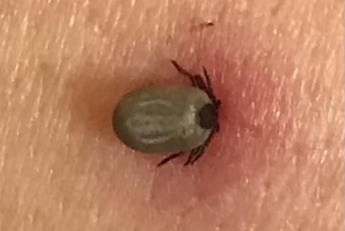
you don’t want to find one of these ticks
The woods are beautiful, but they carry tiny dangers in the form of ticks. After a couple days of hiking up the mountain I found a tick on the back of my shoulder. Maybe not fully engorged, but enough that it had probably been there since the first day, which put it over the 36 hour danger zone for the possibility of contracting Lyme disease. It had black legs so was likely the bad sort of tick that carries it (deer tick). We live where there are no ticks and have no experience dealing with them but found another guest there who knew how to twist ticks out with tweezers.
lower tram station
My only prior experience with a tick was about 30 years ago of the not disease carrying kind (wood tic) in Minnesota. There they burned the tick’s back end so it would pull its head out and not leave any mouth parts behind. Either times have changed as people learn more about them, or it’s the different sort of tick or area of the country because all the locals or people from anywhere that has ticks that we talked to in Vermont said if you do that it regurgitates and you don’t want that because of more likelihood of contracting Lyme disease. Some recommended 2 or 3 weeks of doxycycline just in case and others said wait and see because the doxycycline tears up your stomach and makes you extremely sun sensitive.
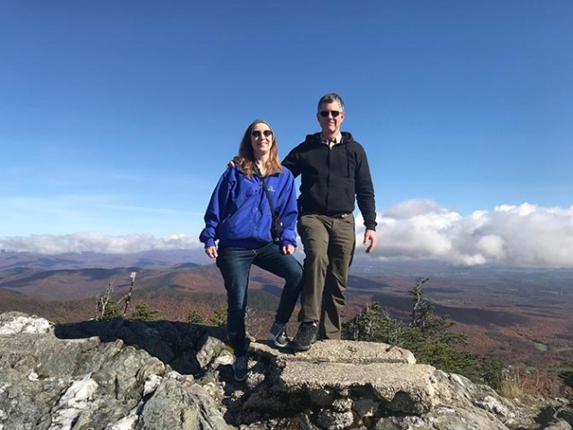
on the top of the world (or at least the top of Jay Peak)
We sent a photo of the tick to our home medical clinic, who of course have no experience dealing with ticks and they did a prescription for one dose of doxycycline as hopefully a preventative and then said watch how it heals because if it heals from the inside so it looks like a bullseye or if I get sick then to come in. Apparently you have 4 weeks from a tick bite to treat for Lymes before it can spread beyond the bloodstream to cause what could become permanent issues. The symptoms for getting sick from it are about the same as Covid or the flu though so that would make it hard to tell.
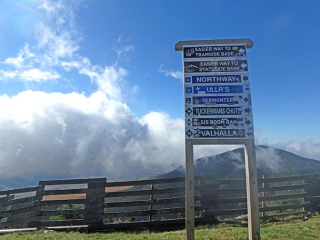
trail sign at the peak
After I got home a friend of John’s contacted a doctor who is a leading expert on Lyme disease and he gave me a 3-week prescription for doxycycline, which meant I was on it a couple weeks later when I went on a Caribbean cruise. Having to avoid sun in the Caribbean is not the best of situations, but better than risking Lyme disease. I got a full-body UV blocking swimming suit, which is handy for snorkeling anyway as it eliminates the need for sunscreen over a large portion of the body. That’s a bonus for the ocean because most sunscreens are very harmful to coral and Caribbean coral is rapidly disappearing. Luckily reef safe sunscreen does exist, but that doesn’t mean everyone uses it. The full body UV blocking swimsuit has an advantage over any sort of sunscreen because it won’t wash off or wear off so you can stay out longer without worrying about getting sunburned. Great for all water sports, not just snorkeling.
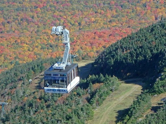
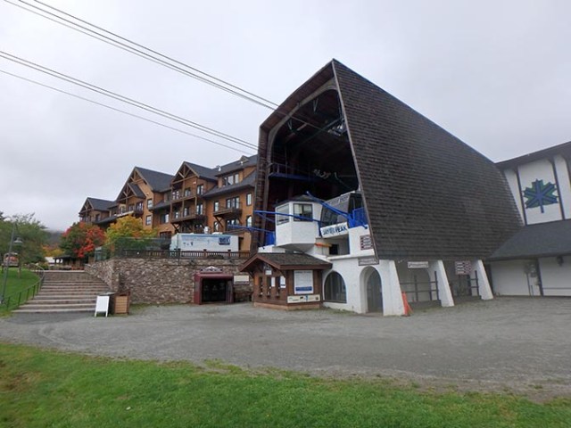
tram at Jay Peak
The tram up the mountain was closed through the beginning of our stay, but opened the day I found the tick. The sun shone brightly that day, the first time since we had been there. Having both wanted to go up the tram and no more desire to hike in the woods we took the tram up after the tick was removed.
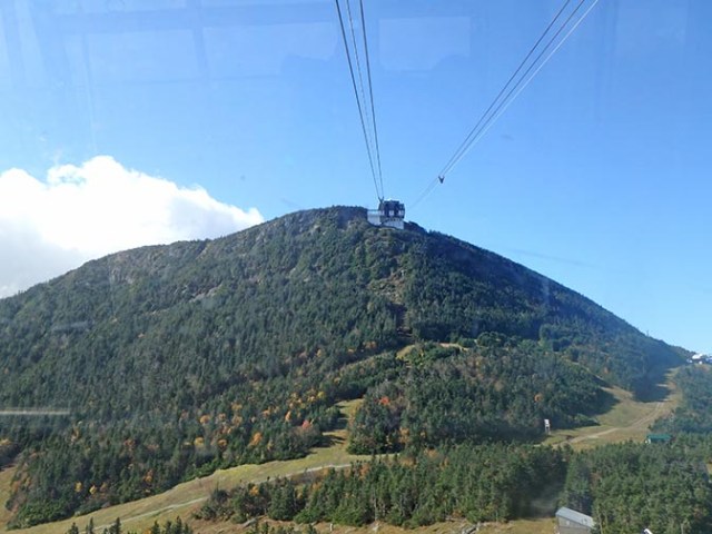
view through the tram window
The ride up the tram is probably beautiful any time of year, particularly so when all the leaves are in their finest fall colors. At the lower part it looks steep when you look up the hill from the tram, but relatively flat looking down. I can attest from walking up it that that is an optical illusion because it is all steep when you hike up it.
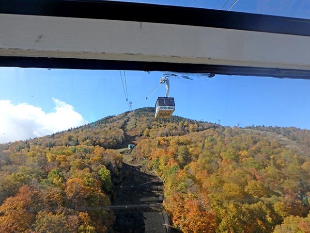
it looks like the tram is nearly to the peak, but that’s just the first peak, not the real peak
What looks like the uppermost tower from the lower part of the hill is really only partway up. The tram goes over the part where the land drops lower a bit after what looks like the peak from lower down, then rises up again behind the little valley that they called the bowl before it gets to the actual peak.
upper tram station
After the bowl there’s a steep rise up the last bit of the mountain. The upper tram stop is just below the highest point of the mountain. The actual peak is jagged rocks so the station is next to it.
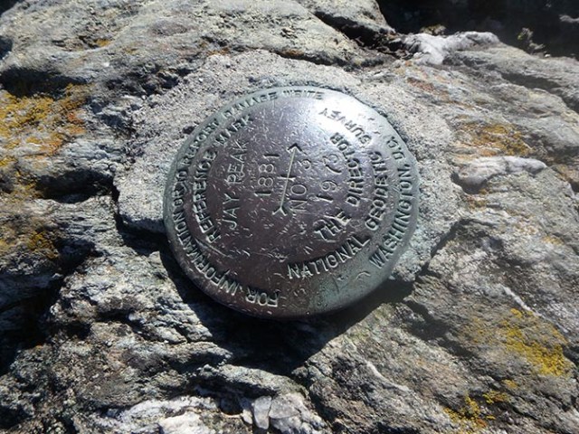
plaque at the top of Jay Peak
Once out of the tram there’s a stairway and then some rocks to climb to get to the actual top of the peak. A small plaque marks the spot. Little puddles in the rocks from recent rain resembled tide pools, but without little sea creatures. The trees are all evergreens up that high, and the ones in the rocky top are all stunted and small like little bonsai trees.
recent rains left little pools in the rock
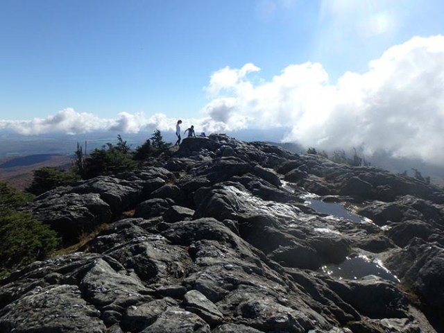
On a sunny day the view is excellent. If the top of the mountain was shrouded in fog as it had been much of the two previous days there probably wouldn’t be much view at all. Especially at the times where from the lodge you couldn’t even see that there was a mountain there at all. The day we went up if you stood in the right spot by the lodge where you could see that second peak you could see all the way up to the tram stop on top, and from the top you could see all of the surrounding area well beyond the lodge.
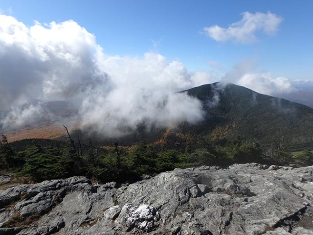
view of the next peak over from Jay Peak
When we first got out of the tram though sunny there, on the far side fog rose from a hollow covering the next peak over, which was quite close by, but the other 3 directions were clear and sunny. That fog rose and drifted away while we were there, leaving that side clear as well.
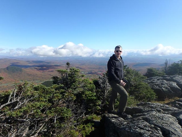
people are taller than the little trees at the top of the peak
The views from the tram and from the top were well worth the price to ride it up there. The building at the top had a restaurant in it, but like most everything else at that lodge it must be for ski season only as it was closed. Some people ride the tram up and then hike down. The upper portion of the hiking trails that go to the top are quite obvious from up there. Having no desire to set foot in that woods again I took the tram back down. The views are better from the tram than from the trails anyway.
